

Burbage Brook cascades 1
Burbage Brook cascades 2
Burbage Brook cascades 3
Dappled light
Padley Chapel
Quarry Shelter
Thistle flower
Limb Brook 1
Limb Brook 2
Limb Brook 3
Side Pike and Langdale Pikes
Beautiful industrial dereliction
Side Pike and Langdale Pikes panorama
Langdale Pikes - the Gothic look
Pike o' Stickle and Gimmer Crag
Derwentwater evening
Eagle Crag overhang
Borrowdale
Lingmoor Tarn 1
Lingmoor Tarn 2
Sunset over the Langdale Pikes
Early demise of the Coal Industry?
Brookhouse shaft
Bolehill incline top
Bluebells
Water sampling
Golden windows
Amazing ceiling - Sheffield City Hall
Cynheidre outburst 1
Cynheidre outburst 2
Dangerous structure
Abandoned Millstone
Valkyrie Pinnacle - a tor on Froggatt Edge
Aqueduct
Intense Redness 2
Intense Redness 1
Tulip with yellow centre
Sex and the Tulip
Hope and Rainbow (it ought to be a pub name)
Stanage Edge after rain
Snowdrops
Old leaves
Stonethwaite valley and Rosthwaite
Rosthwaite and Glaramara, Borrowdale.
North from Wetherlam
1/125 • f/6.3 • 18.0 mm • ISO 400 •
Canon EOS 350D DIGITAL
Location
Lat, Lng:
You can copy the above to your favourite mapping app.
Address: unknown
You can copy the above to your favourite mapping app.
Address: unknown
See also...
Keywords
Authorizations, license
-
Visible by: Everyone -
All rights reserved
-
219 visits
Bolehill Quarries incline
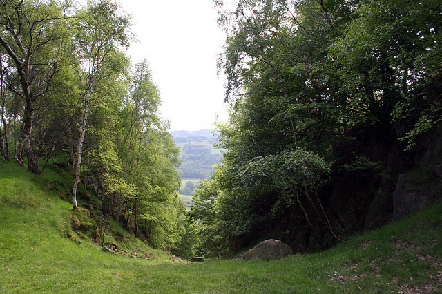

This is the top of the old incline which was used to transport stone from the Bolehill Quarries down to the Derwent Valley where it was then taken by narrow-gauge railway to be used in the construction of the Howden and Derwent Dams.
See also here:
www.wishful-thinking.org.uk/genuki/DBY/Grindleford/BoleHi...
See where this picture was taken. [?]
See also here:
www.wishful-thinking.org.uk/genuki/DBY/Grindleford/BoleHi...
See where this picture was taken. [?]
- Keyboard shortcuts:
Jump to top
RSS feed- Latest comments - Subscribe to the comment feeds of this photo
- ipernity © 2007-2026
- Help & Contact
|
Club news
|
About ipernity
|
History |
ipernity Club & Prices |
Guide of good conduct
Donate | Group guidelines | Privacy policy | Terms of use | Statutes | In memoria -
Facebook
X

Sign-in to write a comment.