


Nevada - Southwest

Folder: Nevada
Esmeralda, Mineral, and Nye counties, including towns and former towns of Hawthorne, Tonopah, Goldfield, Beatty, Pahrump, Belmont, Warm Springs, and Manhattan.
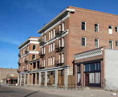
Goldfield NV 1911a
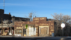
Goldfield NV 1912a
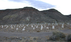
Goldfield NV cemetery 1515
| |
|
On the north end of Goldfield is the cemetery. One of the startling things about this cemetery was that it seemed that just about every burial plot still had some sort of marker -- either an engraved stone, or at least a simple wooden cross.
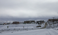
Goldfield, NV
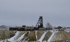
Goldfield, NV (0588)
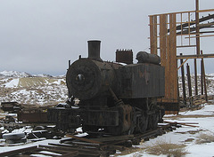
Goldfield, NV locomotive 0589a
| |
|
Steam locomotive shell, Bullfrog Goldfield Railroad yard.
Update 7/4/11: The photo has been getting a lot of hits lately, so one helpful note. There was no description near the locomotive at the time I took the picture, so I can't add anything that will help identify it.
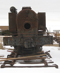
Goldfield, NV locomotive 0590a
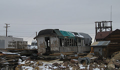
Goldfield, NV railroad passenger car (0591)
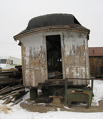
Goldfield, NV railroad passenger car 0595a

Goldpoint NV 1329a
| |
|
The road to Gold Point is about 20 miles south of Goldfield, and then off the main highway (US 95) by almost another 20 miles. Basically it is an inhabited but abandoned town -- which means that there was once a very thriving town there when the mines were active but now there is an agglomeration of people who seem to be living in and around the remains of the town. There are many towns like this in Nevada (and throughout the west), where there seems to be a mix of many abandoned homes and businesses, intermixed with a small number of people some of whom are still living in homes that they originally owned, some are homesteading in abandoned homes, there may be a new home or two, and many people living in all sorts of ad-hoc housing arrangements (older travel trailers, mobile homes, and no longer operative vehicles of various sorts (e.g., school buses)). I.e., people who have decided to separate themselves from the typical, ordinary, customs of life. This is looking towards the town of Gold Point, from a mining platform outside of town.

Hawthorne (NV) Ordnance Museum 0426a

Hawthorne, NV 0427a
| |
|
The town of Hawthorne often looks like it has just been deserted. According to a Wikipedia description of the surrounding Army munitions depot, the military presence varies significantly depending on the types of military conflicts the U.S. is involved in.
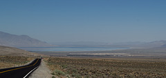
Hawthorne, NV and Walker Lake (0134)
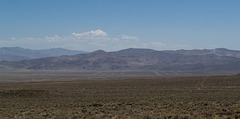
Hawthorne, NV Army ammunition storage depot (0128)
| |
|
|
Per Wikipedia (link below), the Hawthorne Army Depot (HWAD) claims to be the worlds largest ammunition depot and covers 226 sq. miles. It is difficult to capture the size of the depot, though note that the straight lines in the distance are part of it (see the note and satellite view). The other side of valley at this point is roughly 10 miles away. en.wikipedia.org/wiki/Hawthorne_Army_Depot
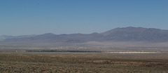
Hawthorne, NV Army ammunition storage depot (0132)
| |
|
|
The very large munitions depot at Hawthorne, NV (see notes on picture). See descriptions in adjacent pictures. The depot started out as the Hawthorne Naval Ammunition Depot established in 1930.
Hawthorne, NV Army ammunition storage depot (0135)
| |
|
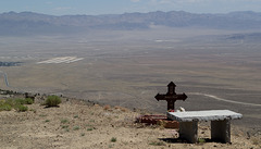
A roadside memorial to someone who lived to age 24, looking over the Hawthorne Army Depot. Taken from relatively close to the top of the Lucky Boy Pass road that runs from Hawthorne to Bodie.
Hawthorne, NV Army ammunition storage depot (0138)
| |
|
|
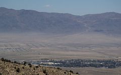
Hawthorne, the Hawthorne Army Depot, and in the distance a graded road that runs from Hawthorne to US 50 east of Fallon. Taken from relatively close to the top of the Lucky Boy Pass road that runs from Hawthorne to Bodie.
Hawthorne, NV El Capitan Casino (0141)
Jump to top
RSS feed- Latest items - Subscribe to the latest items added to this album
- ipernity © 2007-2026
- Help & Contact
|
Club news
|
About ipernity
|
History |
ipernity Club & Prices |
Guide of good conduct
Donate | Group guidelines | Privacy policy | Terms of use | Statutes | In memoria -
Facebook
X
