

Berny's photos
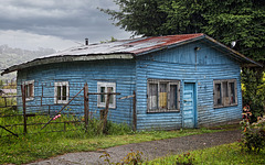
swinging HFF!
| |
|
|
|
The little blue house is standing near Lago Pullinque, Chile.
HFF and a sunny weekend everyone!
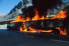
inferno - 3
| |
|
|
|
Burning truck on Ruta 7, driving up to the Chilean border. - scanned slide, Minolta X700
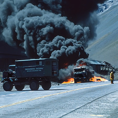
inferno - 2
| |
|
|
|
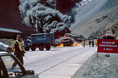
Burning truck on Ruta 7, driving up to the Chilean border. This photo has been taken about 2 hours after the next one. - scanned slide, Minolta X700
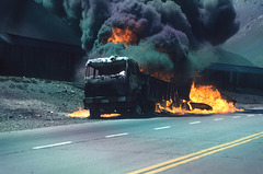
inferno - 1c
| |
|
inferno - 1b
| |
|
inferno - 1
| |
|
|
|
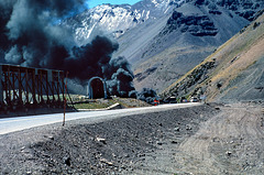
To the left the remains of the Transandine railway, the smoke is caused by a massive truck fire ahead. - scanned slide, Minolta X700
Cerro Gemelos - 5240 m
| |
|
|
|
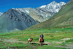
Mountain ridge south of Ruta 7, seen from a short hike into the Parque Aconcagua to the South. - scanned slide, Minolta X700
Cerro Aconcagua - 6961 m
| |
|
|
|
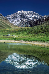
Aconcagua is a mountain in the Principal Cordillera of the Andes mountain range, in Mendoza Province, Argentina. It is the highest mountain in the Americas, the highest outside Asia, and the highest in both the Southern and the Western Hemispheres with a summit elevation of 6961 m. The two "peaks" are Cerro Acongagua Sur (6930m) to the left and Cerro Acongagua (6961m) to the right. The view here is from the "Laguna Horcones" (2979 m), so it's still roughly 4000 m up to the summit ;-) - scanned slide, Minolta X700
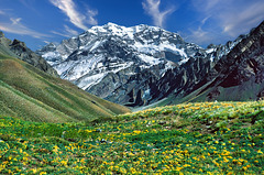
Cerro Aconcagua - 6961 m
| |
|
|
|
Aconcagua is a mountain in the Principal Cordillera of the Andes mountain range, in Mendoza Province, Argentina. It is the highest mountain in the Americas, the highest outside Asia, and the highest in both the Southern and the Western Hemispheres with a summit elevation of 6961 m. The two "peaks" are Cerro Acongagua Sur (6930m) to the left and Cerro Acongagua (6961m) to the right. - scanned slide, Minolta X700
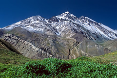
Cerro Quebrada Blanca - 4499 m
| |
|
|
|
Seen from a short hike into the Parque Provincial Aconcagua to the south. - scanned slide, Minolta X700
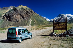
Parque Provincial Aconcagua
| |
|
|
|
The whole region's most famous park is Parque Provincial Aconcagua, home of 6962 m tall Cerro Aconcagua, the highest peak outside the Himalayas and a favorite climbing destination. Reaching the summit requires a commitment of at least 13 to 15 days, including acclimatization time. A part of Aconcagua is seen in the far background. The peak to the left is Agua Salada Norte (4375 m), the mountains to the right are above 5000 m. - scanned slide, Minolta X700
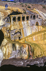
Standing on the edge - Puente del Inca
| |
|
|
|
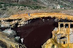
In the year 2000 it was still possible to walk over the bridge. To be honest, it was quite stupid to go so near to the edge, because the surface was slippery and slanting ;-) - scanned slide, Minolta X700
Puente del Inca
Puente del Inca - 2744 m
| |
|
|
|
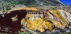
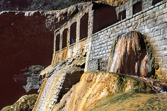
"Puente del Inca" is a natural arch that forms a bridge over the Las Cuevas River, a tributary of the Mendoza River. While the bridge has shown signs of deterioration, it remains stable under its weight under present conditions. In the early 20th century, there was a large thermal resort and monastery that used the hot sulphur springs to cure certain illnesses. There was a railway station, which is still standing, and tourists arrived by train to the resort. The spa was tucked into the side of the cliff, almost underneath the natural bridge. Spring floods, landslides and avalanches destroyed the buildings and the bridge is now closed for foot traffic. Not in 2000, when we still could walk over the bridge. - panorama of 2 scanned slides, Minolta X700 - see PiP
Puente del Inca
| |
|
|
|
Puente del Inca - Transandine Railway
| |
|
|
|
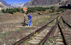
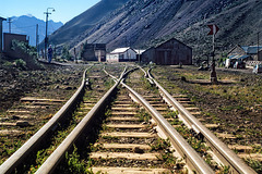
Abandoned facilities of the old "Transandine Railway", which connected Mendoza with Chile, here at the Estacion Puente del Inca (old sulphur baths). The summit in the far background is Cerro Caracoles (4465 m). - scanned slide, Minolta X700
Puente del Inca - Transandine Railway
| |
|
|
|
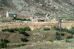
Abandoned facilities of the old "Transandine Railway", which connected Mendoza with Chile, here at the Estacion Puente del Inca (old sulphur baths). The summit in the far left background is Cerro Quebrada Negra (4812 m). - scanned slide, Minolta X700
Capilla Colonial del Puente del Inca
| |
|
|
|
In 1965 one of many avalanches ended the dream of maintaining the thermal hotel in Puente del Inca (ruins in the background). The hotel had been a place of retreat and recreation since 1925. Thermal water was available in each room. The imposing Trasandino Railroad had a station in front of the hotel facilities (some remains in the foreground), which was reached from Mendoza after tunnels, mountains, viaducts and incredible landscapes. That avalanche of 1965 could not, however, destroy the colonial-style Chapel, small and built at the beginning of the 20th century. A first avalanche leaned on the walls of the chapel and served as a shelter for the much more powerful second avalanche, which devastated the hotel facilities. The chapel has been repaired by the army, it remained in operation until 2005. - scanned slide, Minolta X700
