

Berny's photos
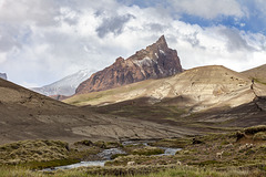
Ruta 41 - Zeballos sheep
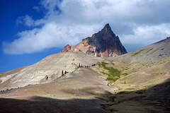
Ruta 41 - Cerro Zeballos
| |
|
|
|
See PiP's for details of the volcanic remains below Cerro Zeballos (Pico Rojo, 2300 m). - scanned slide, Minolta X700 (main image)

Ruta 41 - rock sculptures
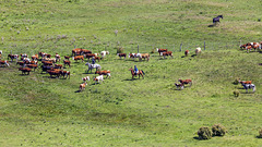
HFF Gauchos!
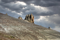
Ruta 41 - rock sculptures
| |
|
|
|
For scale look at the PiP's (my daughter in 2015).....
scanned slide, Minolta X700 (main image)
Ruta 41 - Rio Jeinemeni
| |
|
|
|
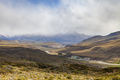
The Rio Jeinemeni is dividing Chile and Argentina. The green slopes and the little lonely Estancia are already Chilean land.
Ruta 41 - on the moon
| |
|
|
|
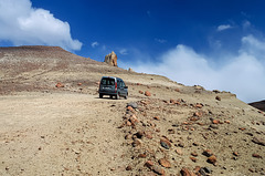
As you can see, the cars have improved a lot over the years from 2000 to 2010 and 2015, from visit to visit ;-)) - scanned slide, Minolta X700 (main image)
Ruta 41 - Zeballos land
| |
|
|
|
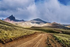
The road meanders through a beautiful and extremely lonesome landscape. The peak to the left is called "Zeballos" (about 2350 m), while the much higher mountain behind is the "real" Monte Zeballos (2743 m, only a little bit can be seen). The 1st PiP is from another trip in 2015, the 2nd from 2010. - scanned slide, Minolta X700
Ruta 41 - Pico Triangular Sur
| |
|
|
|
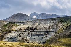
Pico Triangular Sur is the Andes mountain in the background (2588 m), situated on the border between Argentina and Chile. Rio El Zeballos flows below the nice geological formation. - scanned slide, Minolta X700
The two PiP's are photos made in 2015 from the same view point.
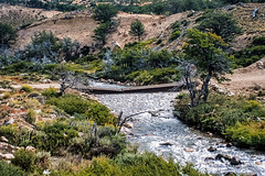
Ruta 41 - mind the weather forecast
| |
|
|
|
You should not enter this road with a bad weather forcast ;-) The "bridge" crosses a tributary to Rio El Zeballos. - scanned slide, Minolta X700
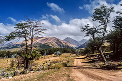
Ruta 41 - unnamed mountains
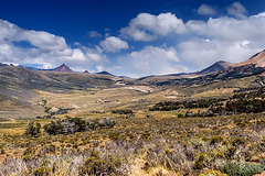
Ruta 41

Ruta 41

Ruta 41 - journey into the unknown
| |
|
|
|
The road leads from Los Antiguos in the North to Lago Posadas in the South, mostly along the Argentinean-Chilean border, surrounded by a very lonesome, beautiful landscape. After bad weather the road is closed quite often. If you drive carefully (you have to) and stop for some photos, you will need about 6 hours for only 160 km. It's easy to underestimate the travel time. - scanned slide, Minolta X700
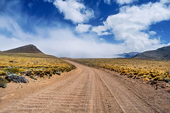
Ruta 41 - journey into the unknown
Ruta 41 - Lago Buenos Aires
| |
|
|
|
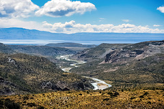
Looking north from Ruta 41 to Lago Buenos Aires and Rio Jeinemeni (across the Chilean border). - scanned slide, Minolta X700
entering Ruta 41
| |
|
|
|
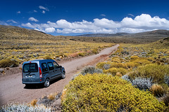
The northern begin of dirt Ruta 41 (south of the village Los Antiguos), called Loma Atravesada. I've done this road 3 times, in 2000, 2010 and 2015. Nothing changed, except a bridge has been built, where in 2000 we had to cross the river bed. The road leads through perfect loneliness and wonderful landscapes. I've made a whole album about this road, if you're interested: www.ipernity.com/doc/berny/album/880040
scanned slide, Minolta X700
Lago Buenos Aires - Ruta 43
| |
|
|
|
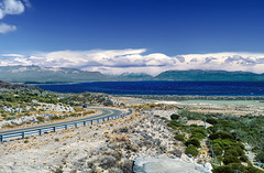
The name of this wonderful lake is "Lago Buenos Aires" on the Argentinean side and "Lago General Carrera" on the Chilean side. It covers 1850 km² and the elevation is 217 m. If you click on the keyword "Lago General Carrera", you can find many further images of this lake!
scanned slide, Minolta X700
