


Iceland - Highlands and F-Roads

Folder: Iceland

Rauðihver
| |
|
|
|
Rauðihver (red hot spring) is a muddy hot spring in Hveravellir (valley of hot springs) high temperature area. Hveravellir lies just off highland road 35 (Kjalvegur) at 650m on the Kjölur plateau between Hofsjökull and Langjökull glaciers. It comprises of at least 150 hydrothermal features and is part of Langjökull central volcano (sometimes also called Hveravellir central volcano).
Rauðihver (rote heiße Quelle) ist ein schlammige heiße Springquelle im Hochtemperaturgebiet Hveravellir. Dieses liegt auf 650m nahe der Hochlandpiste 35 (Kjalvegur) zwischen den Gletschern Hofsjökull und Langjökull und gehört zum Zentralvulkan Langjökull (auch Hveravellir gennant).
de.wikipedia.org/wiki/Hveravellir
Öskurhóll
| |
|
|
|
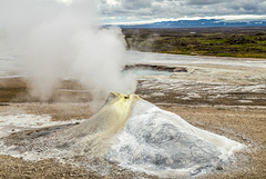
Öskurhóll (roaring hill) is a fumarole with sinter mound in Hveravellir geothermal area. It makes a constant loud noise like a tea kettle gone mad. In the background Bláhver hot spring can be seen.
Öskurhóll (brüllender Hügel) ist eine Fumarole mit Sinterhügel im Hochtemperaturgebiet Hveravellir, die ständig pfeift wie ein wildgewordener Teekessel. Im Hintergrund sieht man die heiße Quelle Bláhver.
Hveravellir
| |
|
|
|
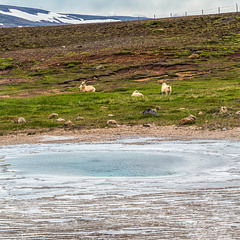
HFF everybody!
For all who haven't seen the good news from IMA: www.ipernity.com/group/2260604/discuss/187672
Eyvindarrétt
| |
|
|
|
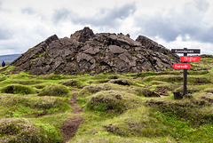
Tumulus in a lava field near Hveravellir. Tumuli are lava crusts upliftet by pressure of fluid pahoehoe lava from below and are typically cracked along their axis.
This one was used as a sheep pen by Iceland's most famous outlaw, Fjalla Eyvindur (1714-1783). He and his wife Halla are said to have survived 20 years in the highlands where most thermal areas are associated with them.
In the notes: Eyvindarhver, the hot spring where they did their cooking and Eyvindarkofi, the lava cave which served as their shelter.
Tumulus in einem Lavafeld bei Hveravellir. Tumuli entstehen aus erstarrter Lavakruste, die durch den Druck noch flüssiger Pahoehoe-Lava darunter angehoben wird, typisch sind die axialen Risse.
Dieser Tumulus wurde von Islands berühmtestem Outlaw, Fjalla Eyvindur (1714-1783), als Schafpferch benutzt. Er und seine Frau Halla sollen 20 Jahre im Hochland überlebt haben, fast jede thermale Oase wird mit ihnen in Verbindung gebracht.
In den PiPs: Eyvindarhver, die heiße Quelle, die sie als Kochtopf benutzt haben und Eyvindarkofi, eine Lavahöhle, ihre "Wohnung".
Kjalvegur
| |
|
|
|
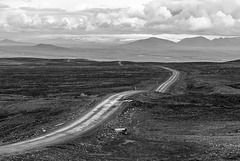
Highland route 35 (Kjalvegur) traverses the highlands from north to south, starting near Blönduós and leading over the Kjölur plateau between Langjökull and Hofsjökull glaciers to Gullfoss. Since all rivers have been bridged, the 168 km long mountain road can now also be used by normal cars though it is like washboard in many places.
This photo was taken near the pass at Bláfell looking south.

Highlands
| |
|
|
|
SC 151- Composition Rules - here: Rule of Thirds (1), Layering (3).
Alternative contribution:: Golden Ratio (12) www.ipernity.com/doc/523247/52967388
On Hringvegur through the Icelandic Highlands in wintry conditions- ice, snow and high winds.

Möðrudalsöræfi Panorama
| |
|
|
|
View from the pass over Möðrudalsfjallgarður. What is now road 901 used to be part of the ring road until 2005. Möðrudalsöræfi consists of dolerite and palagonite bedrock with cones and ridges from late ice age fissure eruptions.
Large size:
www.ipernity.com/doc/523247/35794459/sizes/o
Desolation of Mordor
| |
|
|
|
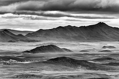
Möðrudalsöræfi seen from the viewpoint on Road 901/ Möðrudalsleið. A barren wilderness of cones and ridges from subglacial fissure eruptions during the last ice age.
A panorama of the whole vista in colour:
www.ipernity.com/doc/523247/35794459
Abandoned
| |
|
|
|
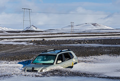
Presumably the driver got help, as this is in front of a café and filling station - even though it's in the middle of nowhere!
Þetta reddast (it will work out alright) as Icelanders like to say;-)
Our bus got stuck in an official beach parking lot. The driver googled the nearest farm, called them and they came with a tractor and pulled him out. We missed the fun because we went for a walk in the meamtime.
Beitarhúsið
| |
|
|
|
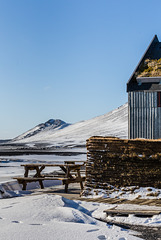
Café in the middle of the highlands just off the ring road. It belongs to the 8 km distant farm of Möðrudalur, at 469m the highest inhabited place in Iceland (and in winter only reachable by superjeep).
At around -10°C and with a very strong wind nobody wanted to sit outside;-)
HBM!
Möðrudalskirkja
| |
|
|
|
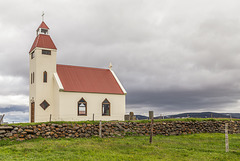
Möðrudalur (469m) is the highest and most isolated populated place in Iceland. It has been a working (sheep) farm since settlement times. The church was built in 1949 by farmer Jón Stefánsson in memory of his late wife.He also painted the picture over the altar (see note).
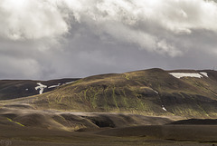
Slórfell from F905
| |
|
|
|
Road F905 branches south near Möðrudalur, passing along the palagonite range of Möðrudalsfjallgarður until connecting with F910 towards Askja. In dry and windy weather the area is prone to sandstorms.
Highland roads
| |
|
|
|
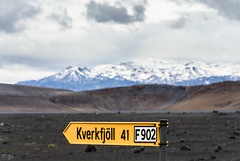
SC204- street signs
On F910 (Austurleið) at the turn-off to F902. The mountain in the background of the volcanic wasteland is Askja volcano.
F in a road name means Fjall (mountain), these tracks are only suitable for large 4x4 (no Dacia Dusters!), they are not surfaced, have river crossings and can be quite challenging. They are open only in summer (late June/ July - September/ early October depending on the weather).
Police and rangers are patrolling the highlands to help if someone runs into trouble and to make sure nobody does any offroad driving which is strictly forbidden.
Fines can be up to 1 million krona (not quite 7000 Euros) which many Icelanders think is much too low. A recent case of vandalism caused quite a stir:
icelandmonitor.mbl.is/news/nature_and_travel/2026/06/30/french_tourists_believed_to_have_reached_isafjordur
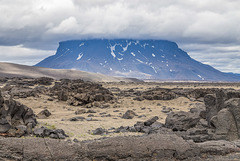
Herðubreið, the queen of Icelandic mountains
| |
|
|
|
Herðubreið (1682m) is a classic tuya (subglacial volcano) topped by a 300m thick subaerial lava shield. The photo was taken near the bridge over River Kreppá, the lava and pumice in the foreground stem from Askja eruptions.
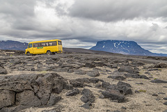
On Highland Road F910-Austurleið
| |
|
|
|
After the Kreppá bridge F910 meanders through Krepputunga before doubling back to cross Jökulsá a Fjöllum. Móberg ridge Herðubreiðartögl and table volcano Herðubreið can be seen in the background, the foreground is filled with lava and pumice from Askja eruptions.
Version with selective colouring added!
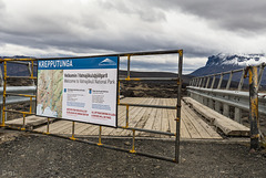
Kreppá Bridge
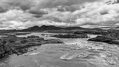
Highland desert
| |
|
|
|
River Kreppá in the Icelandic highlands, a desert of lava and pumice created by various volcanic eruptions, most notably from Askja. www.vatnajokulsthjodgardur.is/en/areas/odadahraun/interpretation-and-knowledge/about-askja
Road F910 (4x4 only) crosses the river on one of the very few bridges in the area. Note how high the bridge is, fording would often be impossible.
www.vatnajokulsthjodgardur.is/en/areas/odadahraun
I'm off to Iceland again, see you in August!
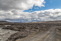
River Kreppá and Austurleið
| |
|
|
|
Highland Road F910 and river Kreppá, the major tributary of Jökulsá a Fjöllum. A jökulhlaup (glacier outburst flood) from Vatnajökull would reach this area in less than 3 hours: avd.is/is/wp-content/uploads/2014/10/Jokulhlaup_kort_Holuhraun_20141017.png
Jump to top
RSS feed- Latest items - Subscribe to the latest items added to this album
- ipernity © 2007-2026
- Help & Contact
|
Club news
|
About ipernity
|
History |
ipernity Club & Prices |
Guide of good conduct
Donate | Group guidelines | Privacy policy | Terms of use | Statutes | In memoria -
Facebook
X
