Altiplano
Folder: Latin America
Mina Concordia
| |
|
|
Tren a las Nubes circles round this abandoned gold mine at 4144m. Coming back from Viaducto de Polvorilla the train stops at the station to shunt the locomotive for the descent to Salta.
Tren a las Nubes at San Antonio des las Cobres
| |
|
|
|
Tren a las Nubes is run as a tourist train from Salta (1187m) to Viaducto de la Polvorilla (4188m). It uses part of the Salta-Antofagasta railway line which used to connect both towns. Passenger trains ran until 1981, after that only freight trains used the track. The line was designed by American engineer Richard Fontaine Maury, construction started in 1921 and was finally finished in 1948. On the Tren a las Nubes section there are 2 horseshoe curves, 2 zig zags, 29 bridges, 13 viaducts and 21 tunnels.
Ruta 52
| |
|
|
|
Ruta 52 through Salinas Grandes. Salinas Grandes lies at 3450m, is 212 km² large and has a 30 cm thick salt crust.
See inset photo for a different version.
Salinas Grandes del Noroeste (PiP)
| |
|
|
|
Salinas Grandes lie in the northeastern corner of Argentina at a height of ca. 3450m. They cover 212 km² and are traditionally mined for salt. Recent explorarion for lithium has led to conflict with the indigenous population whose water supplies are threatened by mining.
Die Salinas Grandes liegen im Nordosten Argentiniens auf 3450m Höhe und erstrecken sich über 212 km². Traditionell wird dort Kochsalz abgebaut. Kürzliche Erkundungen wegen Lithiumabbaus haben zu Konflikten mit der indigenen Bevölkerung geführt, deren (Grund-)Wasservorräte dadurch gefährdet sind.
Espinazo del Diablo
| |
|
|
|
Espinazo del Diablo (the devil's backbone) rises to above 4000m near Tres Cruces, Jujuy, in the far north of Argentina. It is a colourful formation of sedimentary folds, formed in the Tertiary period above older rocks of Paleozoic and Mesozoic origin. This outcrop, known as Santa Barbara subgroup is made up of sedimentary rocks of continental origin, loam, sandy loam and calcareous claystones with frequent fossil remains of algae.
EXIF: 1/100 • f/8.0 • 57.0 mm • ISO 100/ Canon EOS 350D/18.0-200.0 mm
Laguna Miscanti - view full size!
| |
|
|
|
EXIF: 1/250 • f/9.0 • 47.0 mm • ISO 100/ Canon EOS 350D/ 18.0-200.0 mm
stitched from 21 verticals
Laguna Miscanti lies at 4140m in the Chilean Altiplano and is part of Reserva Nacional Los Flamencos . It is a brackish lake (fed only by rain and groundwater) that was separated from neighbouring Laguna Miñiques by a lava flow.
See notes and insets!
Volcanes Chiliques y Miscanti
Volcán Miñiques
Salar de Surire- view full size!
| |
|
|
|
Salar de Surire is situated at 4245m near the border to Bolivia. It is part of UNESCO's Lauca Biosphere Reserve and a Ramsar Wetland .
Nevertheless it is only listed as a Monumento Natural (the lowest level of protection) by the Chilean authorities because of Lithium mining.
EXIF: 1/160 • f/9.0 • 31.0 mm • ISO 100/ Canon EOS 350D/ 18.0-200.0 mm
stitched from 21 verticals
Volcán Parinacota
| |
|
|
|
Parinacota (6336m) is the southermost peak of the Nevados de Payachatas range. It is here seen from Lago Chungarà, one of the world's highest lakes at 4517m. In the foreground are the typical Altiplano wetlands ("bofedales").
Refuelling
| |
|
|
|
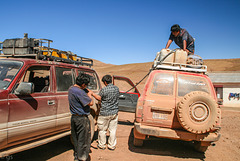
In thinly populated SW Bolivia filling stations are very rare. Cars need to carry their petrol on the roof, refuelling is done as seen in the photo. After 3 days of bumpy tracks one of the canisters started leaking and needed to be emptied.
Butch Cassidy's last resting place (PiP)
| |
|
|
|
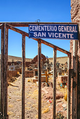
Supposedly Butch Cassidy and Sundance Kid were shot and buried in San Vicente, a zinc and silver mining town situated at 4498m in SW Bolivia.
content.time.com/time/world/article/0,8599,1951085,00.html
Deutsch: de.wikipedia.org/wiki/San_Vicente_(Potos%C3%AD)
HFF everybody!
San Antonio del Nuevo Mundo (3xPIP)
| |
|
|
|
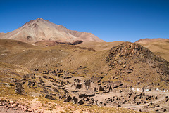
San Antonio del Nuevo Mundo was a mining town which at its peak in the 17th century had about 150.000 inhabitants. It is said that even in precolumbian times the Inca mined there for silver. When water repeatedly flooded the mine shafts the town and mines were given up. Though an enormous amount of silver is said to remain in the mountain the altitude and remote location make mining uneconomical.
The mountain in the background is the lower (>5900m) of the twin peaks of Cerro Lípez, a 5929 m high stratovolcano.
In the notes the ruins of the old and "new" church and an altitude sign.
San Antonio del Nuevo Mundo war eine Bergwerksstadt, die zu ihren besten Zeiten im 17. Jh ca. 150.000 EInwohner hatte. Vermutlich wurde dort schon in vorkolumbianischen Zeiten von den Inka SIlber abgebaut.Wegen wiederholter Wassereinbrüche wurden Stadt und Minen aufgegeben, es sollen aber noch gewaltige Mengen an Silber im Berg sein. Wegen der Höhe und sehr abgelegenen Lage ist der Abbau derzeit nicht wirschaftlich.
Der Berg im HIntergrund ist der niedrigere der Doppelgipfel des Vulkans Cerro Lípez (5929m), der aber auch noch mehr als 5900m hoch ist.
In den PiPs die Ruinen der alten und "neuen" Kirche sowie eine Höhenangabe.
Thin air
| |
|
|
|
A nameless pass at 4929m in the remote SW corner of Bolivia
Ein namenloser Pass auf 4929m Höhe im abgelegenen südwestlichen Zipfel Boliviens
Laguna Morijón and Volcán Uturuncu (PiP)
| |
|
|
|
6008m high Uturuncu made it into the news some time ago when scientists published a paper about a yearly uplift of 1-2cm over a 70km radius around the volcano. Subsequently Uturuncu was hyped as a supervolcano bringing doom to mankind.. That's not going to happen any time soon though;-)
www.nytimes.com/2012/02/14/science/a-fascinating-growth-spurt-at-the-uturuncu-volcano-in-bolivia.html
Der 6008m hohe Uturuncu wurde in der Presse vor einiger Zeit als neuer Supervulkan gehypt, aber die Weltuntergangsszenarien werden sicher noch ganz lange Zeit nicht eintreffen, wenn überhaupt je... Hintergrund war eine wissenschaftliche Studie, die feststellte, dass sich in einem 70km-Radius die Erde um 1-2cm pro Jahr hebt.
www.vulkane.net/vulkane/uturuncu/uturuncu.html
www.spiegel.de/wissenschaft/natur/uturuncu-in-den-anden-forscher-entdecken-neuen-supervulkan-a-823405.html
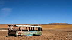
Estacionamento - parked forever!
Salar de Chalviri
| |
|
|
|
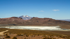
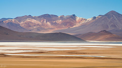
Salar de Chalviri is a salt flat in SW Bolivia at a height of ca. 4400m. It lies in the National Reserve of Andean Fauna Eduardo Avaroa and the whole area is part of the huge Altiplano-Puna Volcanic complex with its large nested calderas and geothermal areas.
volcano.oregonstate.edu/altiplano-puna-volcanic-complex
Der Salar de Chalviri ist eine Salzwüste auf ca. 4400m im südwestlichen Bolivien und Teil des Nationalparks Eduardo Avaroa für andine Fauna. Die ganze Gegend gehört zum riesigen Altiplano-Puna Vulkankomplex (APVC) mit unzähligen Vulkanen, riesigen Calderen und Geysirgebieten. Der APVC wird mit gerne mit Yellowstone verglichen und oft als Supervulkan gehypt.
Salar de Chalviri
| |
|
|
|
Part of Reserva Nacional de Fauna Andina Eduardo Avaroa in SW Bolivia - the "Bolivian Tibet"
Salar de Chalviri
| |
|
|
|
Salt flat with lagoons and hot springs, situated at ca. 4400m in Eduardo Avoaroa National Park in SW Bolivia
en.wikipedia.org/wiki/Eduardo_Avaroa_Andean_Fauna_National_Reserve
Salzpfanne mit Seen und heißen Quellen, auf ca. 4400m Höhe im Eduardo Avaroa Nationalpark im Südwesten Boliviens gelegen.
de.wikipedia.org/wiki/Reserva_Nacional_de_Fauna_Andina_Eduardo_Avaroa
Laguna Salada
| |
|
|
|
Laguna Salada (ca. 4400m) is part of Salar de Chalviri in Eduardo Avaroa National Park, SW Bolivia
Jump to top
RSS feed- Latest items - Subscribe to the latest items added to this album
- ipernity © 2007-2024
- Help & Contact
|
Club news
|
About ipernity
|
History |
ipernity Club & Prices |
Guide of good conduct
Donate | Group guidelines | Privacy policy | Terms of use | Statutes | In memoria -
Facebook
Twitter

