

An Outting
Crossings on the Willimantic
Summer on the river
Intertribal Dance
Crow Hop Dance
Boston Turnpike I
Boston Turnpike II (Old Turnpike Road)
Ford way, Circa 1730 - 1746 continued.
Ford way, Circa 1730 - 1746
Sewists
Singers, Lake Siog, Holland MA, 2015
Pine Hill - Chism Mill Road
Moose Meadow Village
Westford/Moose Meadow Road
A Map of the Mohegan Sachems Hereditary Country
The Pine or Meeting House Hill
American Paint and Trap
Boston Turnpike
Tailoring
Town Hall
See also...
Keywords
Authorizations, license
-
Visible by: Everyone -
All rights reserved
-
253 visits
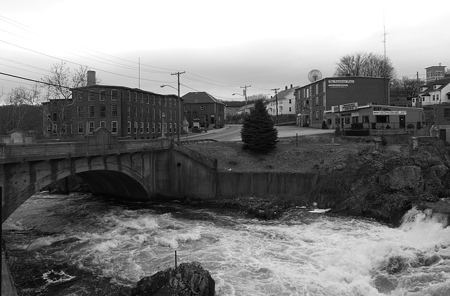
Pomfret Street Bridge, Cargill Falls, Putnam

From here, a path ran northwest to Plaine Hill in Woodstock and a path ran southwest to the Pine or Meeting House Hill in Ashford.
There are photos of the 1955 flood in the park adjacent to the falls. One showing the water running over the bridge.
The flood of '55:
www.norwichbulletin.com/news/x776063271/Victims-recall-devastation-of-1955-flood-that-left-Putnam-in-ruins?photo=0
There are photos of the 1955 flood in the park adjacent to the falls. One showing the water running over the bridge.
The flood of '55:
www.norwichbulletin.com/news/x776063271/Victims-recall-devastation-of-1955-flood-that-left-Putnam-in-ruins?photo=0
Xata has particularly liked this photo
- Keyboard shortcuts:
Jump to top
RSS feed- Latest comments - Subscribe to the comment feeds of this photo
- ipernity © 2007-2026
- Help & Contact
|
Club news
|
About ipernity
|
History |
ipernity Club & Prices |
Guide of good conduct
Donate | Group guidelines | Privacy policy | Terms of use | Statutes | In memoria -
Facebook
X

Of course seen in “The MUSEUM”
Sign-in to write a comment.