

Crete - Traffic
Ierapetra
Ierapetra
Ierapetra
Ierapetra - Archaeological Collection
Ierapetra - Archaeological Collection
Ierapetra - Archaeological Collection
Ierapetra - Archaeological Collection
Ierapetra - Archaeological Collection
Ierapetra - Archaeological Collection
Ierapetra - Archaeological Collection
Ierapetra - Archaeological Collection
Ierapetra - Archaeological Collection
Ierapetra - Archaeological Collection
Ierapetra - Archaeological Collection
Ierapetra - Archaeological Collection
Ierapetra - Archaeological Collection
Agios Nikolaos - Wash and Go
Agios Nikolaos - Wash and Go
Malia - Booze Cruise
Malia - Go-Go
Malia - McDonald’s
Malia - Spar
Crete - Psiloritis massif
Chania - Throumbi sti Ladokolla
Chania - Throumbi sti Ladokolla
Chania - Throumbi sti Ladokolla
Chania - Kiosk
Chania - Italian Barracks
Chania
Chania
Chania
Chania - Sabbionara Bastion
Chania - Fourogatos
Chania - Fourogatos
Chania - Fourogatos
Chania - Hasan Pasha Mosque
Chania - Hasan Pasha Mosque
Chania - Harbor
Chania - City Wash
Chania
Chania
Rethymno - To Havesiliki
Rethymno - To Havesiliki
Rethymno - To Havesiliki
Location
Lat, Lng:
You can copy the above to your favourite mapping app.
Address: unknown
You can copy the above to your favourite mapping app.
Address: unknown
Keywords
Authorizations, license
-
Visible by: Everyone -
All rights reserved
-
13 visits
Crete - Psiloritis massif
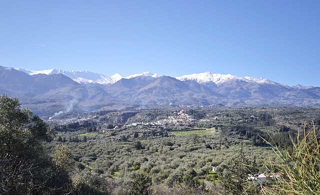

Crete, the largest and most populous of the Greek islands, is located about 100 km south of the Peloponnese. Crete was the center of Europe's first advanced civilization, the Minoans, from 3000 to 1400 BC. The Minoan civilization was overrun by the Mycenaean civilization from mainland Greece. Crete was later ruled by Rome, then successively by the Byzantine Empire, the Byzantine Empire again, the Venetian Republic, and the Ottoman Empire. In 1898 Crete, whose people had for some time wanted to join the Greek state, achieved independence from the Ottomans, formally becoming the Cretan State. Crete became part of Greece in December 1913.
The highest peak in the massif is Psiloritis, at 2,456 metres. It is surrounded by four other peaks over 2,200 metres high: Agathias (2,424 metres), Stolistra (2,325 metres), Voulomenou (2,267 metres) and Koussakas (2,209 metres).
The highest peak in the massif is Psiloritis, at 2,456 metres. It is surrounded by four other peaks over 2,200 metres high: Agathias (2,424 metres), Stolistra (2,325 metres), Voulomenou (2,267 metres) and Koussakas (2,209 metres).
William Sutherland, Don Sutherland, appo-fam, Nicole Merdrignac and 2 other people have particularly liked this photo
- Keyboard shortcuts:
Jump to top
RSS feed- Latest comments - Subscribe to the comment feeds of this photo
- ipernity © 2007-2026
- Help & Contact
|
Club news
|
About ipernity
|
History |
ipernity Club & Prices |
Guide of good conduct
Donate | Group guidelines | Privacy policy | Terms of use | Statutes | In memoria -
Facebook
X

Sign-in to write a comment.