Nederland: natuur en landschap
Folder: Nederland - the Netherlands
Foto's van Nederlandse landschappen en natuur.
Voor foto's van bloembollen zie: www.ipernity.com/doc/294067/album/1303332
Voor foto's van bloembollen zie: www.ipernity.com/doc/294067/album/1303332
Nederland - ‘t Harde, Ampies Berg
| |
|
|
|
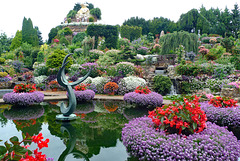
I don’t know if Ampies Berg (Ampies Mountain) is the most beautiful garden, but for sure it is the most remarkable one I have ever seen. As soon as I entered the garden I was overwhelmed by the explosion of colours of hundreds and hundreds of different flowers and plants.
It is a long time ago when Ampie and Batje Bouw during a holiday were inspired by the Austrian landscape. At home he decided to make a piece of Austria is his own garden with waterfall, a pond, beautiful flowers and a mountain with a height of fifteen meters. They have been working for more than fifty years creating their own floral paradise.
Nederland - Harderwijk, Beekhuizerzand
| |
|
|
|
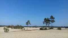
Beekhuizerzand: a Dutch mini desert.
It is one of the few remaining drift sand areas in the Netherlands and even Europe. Beekhuizerzand is an area of about 200 hectares. It had to be restored in 2004 from a wooded area to the drift sand in its current shape. Many pines have been cut for this transformation. The top layer of the soil was removed; causing the wind can do its work again.
Drift sand areas are unique natural landscapes in western Europe, most of them can be found in the Netherlands. They have their own flora and fauna. Characteristic plants and animals are the lichens and the sand lizards. The temperatures in a drift sand area can vary considerably. Sometimes it freezes at night, but during the day the temperature can rise to 40 degrees Celsius.
Nederland - Haren, Hortus Botanicus
| |
|
|
|
The Hortus Botanicus in Haren is one of the oldest and largest botanical gardens in the Netherlands. It was founded in 1626 by the pharmacist and botanist Henricus Munting and was originally situated in the city of Groningen. Because of space considerations it relocated to its current location; from 1929 on a new botanical graden was created on that site and became the largest botanical garden in the country.
At the Hortus, which covers about 20 acres, there are a large number of very different gardens. Among others the garden consists of an arboretum, pinetum, English garden, a water garden, a rock garden, bamboo garden, a grass garden, agricultural gardens, and Celtic gardens. Since 1995 it also has a walled Chinese Garden .
The Hortus was part of the University of Groningen and until the 1980s’ played an important role in the teaching and research of biology especially. Since 2002 a foundation is managing the gardens.
We visited the Hortus in late October, so there were almost no flowers to be seen. We just could make a walk along trees and shrubs in beautiful autumn colours.
Nederland - Haren, Horus Botanicus / Chinese Garde…
| |
|
|
|
The Chinese Garden - part of the Hortus Botanicus Haren was built in 1995 after an earlier visit of a Groningen trade mission to several cities in China. It is a historical reconstruction of a garden from the Ming period. The walled garden was designed a famous Chinese urban garden architect from Shaghai.
Almost all the material used to build the Chinese Garden was shipped from China to the Netherlands, from the stones in the garden and the wood of the pavilions to the furniture of tea house. Chinese workers laid out the park largely by hand. The result of this cooperation between the Netherlands and Shanghai is the beautiful Chinese garden “The Hidden Kingdom of Ming”, which was officially opened by H.M. Queen Beatrix in 1995.
Nederland - Zeeland, Hedwigepolder
| |
|
|
|
Hedwigepolder, or officially Hertogin Hedwige Polder. The name refers to Hedwige de Ligne, Duchess of Arenberg, wife of Engelbert IX Duke of Arenberg. The streets in the polder bear the names of the Duke and Duchess and their three children.
Hedwigepolder is located on the border between the Netherlands and Belgium, just south of the harbours of Antwerp. The area became a polder already before the Eighty Years' War. During this war, in 1584, Dutch soldiers inundated for strategic reasons the area. In the 17th century diking restarted and in 1907 the Hedwigepolder was the last territory, which was reclaimed from the sea in the eastern corner of the Dutch province of Zeeland.
Although there was (and is) a lot of protest the Hedwigepolder, an area of fertile farmland, soon will be returned to the sea, being part of an agreement between Belgium and the Netherlands to compensate for land, lost through the deepening of the River Scheldt, a waterway connecting the port of Antwerp to the North Sea. It becomes (again) part of the so called ‘Verdronken Land van Saeftinghe’ (The Drowned Land of Saeftinghe).
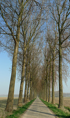
Picture: the poplar lined Engelbertstraat.
More info ‘Verdronken Land van Saeftinghe’: saeftinghe.eu/en
Nederland - Heerde, Pluizenmeer
| |
|
|
|
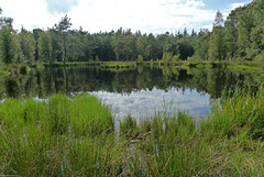
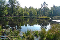
Heerde: Pluizenmeer or Pluizenmeertje. It is named after 'veenpluis' (common cottongrass), which is growing along this little lake. In the older days it was used for washing the sheep from nearby 'Renderklippen'.
Nederland - Heerde, Pluizenmeer
| |
|
|
|
Pluizenmeer or Pluizenmeertje is a so called mere, which is filled with rainwater that does not sink into the ground because of an impermeable layer. This little ‘lake’ is named after veenpluis (common cottongrass), which used to grow here a lot. In the older days it was used for washing the sheep from nearby Renderklippen .
Nederland - Hoenderloo, toverhazelaar
| |
|
|
|
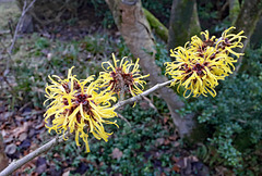
The special thing about the toverhazelaar (Witch Hazel) is that this shrub blooms in the winter months (from the end of December/beginning of January with yellow/orange spidery flowers).
The name toverhazelaar comes from the English "Witch-hazel", which is actually derived from "Wice-hazel". Because of this flexibility, this hazel is also said to have been frequently used as a dowsing rod.
The first witch-hazel imported into the Netherlands was the American 'Hamamelis virginiana'. This was a medicinal plant among the Indians. It is still used for medicinal purposes today
Nederland - Hoog Buurlo
Nederland - Hoog Buurlo
| |
|
|
|
Hoog Buurlo is an agricultural enclave amidst heathland, woods and beech avenues. Field farming, keeping sheep and chopping oak (tannic acid from oak bark was used in the tannery) provided the necessary income. Hoog Buurlo is most probably the smallest hamlet of the Netherlands, with two former farmhouses, two sheepfolds, just a couple of residents and over a hundred sheep.
The name (Hoog) Buurlo appears already in the 9th century and is a combination of "bur" (small house) and "lo" (forest). The hamlet is well known for its sheepfold and herd. It attracts many visitors, especially in spring when lambs are born.
Nederland - Hoog Soeren
| |
|
|
|
Grove of trees on the golf course of the Veluwse Golf Club.
PiP's: During winter (and snow) no golf players but children using their sleds.
Apeldoorn - Hoog Soeren, Groene Poeltje
| |
|
|
|
The Groene Poeltje (Little Green Puddle) is situated just outside the village of
Hoog Soeren in a small valley of a hill named Pomphul . The valley with the puddle has probably already had an attraction and significance for the inhabitants of this elevated part of the Veluwe in prehistoric times. The nearby burial mounds in prove that people lived here from an early age.
Due to the high altitude of Hoog Soeren, obtaining sufficient drinking water was often a problem in the past. Around 1800 a pump was installed in the valley of Pomphul. When in summer the rain barrels and wells in Hoog Soeren were dry, the villagers had to fetch water from Groene Poeltje with a barrel on a barrow. The trip with the heavy barrow back up to the village was quite a job. In 1927 the village became its own water piping.
Since the 17th century, however, a water pipe made of lead, wooden and earthenware pipes ran from Pomphul to the gardens of Het Loo Palace . The construction of this 13-kilometer long pipeline was commissioned by king Willem III. The difference in height of about 30 meters caused an enormous water pressure. The final result were 20 fountains, each 4 meters high and one fountain 13 meters high; the highest spouting fountain in Europe !!
Nederland - Hoog Soeren, Aardhuispark
| |
|
|
|
The Aardhuispark is a fenced-off part of Kroondomein Het Loo (The Loo Royal Estate). It is situated - as the name suggests - around Het Aardhuis . The park offers a mixture of open landscape with a wildlife meadow, lanes with old beech and oak trees and water pools.
A three-kilometre walking route has been marked out in the park. This route also leads to a hideout for wildlife spotting. During my last visit, I saw a group of 15 to 20 deer grazing and resting there (PiP1).
Nederland - Jelsum, Dekema State
| |
|
|
|
Dekema State: drive way from the Dekemawei to the mansion with lime trees pruned like a candelabrum. (De oprijlaan met gecandelaberde linden, ook wel 'zwarte singel' genoemd'.)
Nederland - Singer Laren, beeldentuin
| |
|
|
|
The Singer Laren sculpture garden is designed by Piet Oudolf, a well-known Dutch garden architect. The garden contains sculptures by contemporary Dutch artists, all of them on the theme of the relationship between culture and nature.
The Singer Laren sculpture garden is accessible free of charge.
Nederland - Klarenbeek, Beekbergerwoud
| |
|
|
|
Beekbergerwoud: a 'new' nature reserve, restored on the location of the last Dutch primeval forest, which was cut down in 1871.
Nederland - Kloosterhaar, Engbertsdijksvenen
| |
|
|
|
The Engbertsdijksvenen owes its name to the Engberts farming family. The area used to consist of a four to seven meter thick layer of peat that was formed around 10,000 years ago. The original peat bog was about 180,000 hectares in size. Peat extraction started relatively late and was a small-scale operation until the 19th century. Farmers used the peat for their own needs, for instance to stoke their stoves. At the beginning of the 20th century, the peat extraction of the Engbertsdijksvenen was done on a large scale and lasted until the middle of the last century.
From 1953, Staatsbosbeheer (a Dutch government organization for forestry and the management of nature reserves) bought land in the Engbertsdijksvenen . Peat was last excavated in 1984. The area covers an area of 1,000 ha. A small core of peat of about 17 ha still has its original thickness. Only 25 hectares of "living" raised bog remain in the Netherlands.
The Engbertsdijksvenen has been given a protected status in several respects. The Staatsnatuurmonument (National natural monument) has also been designated a Natura 2000 area. It is therefore part of a European network of high-quality nature reserves. It is an international wetland and the largest and most important raised bog area in Western Europe.
Nederland - Kootwijk, Kootwijkerzand
Jump to top
RSS feed- Latest items - Subscribe to the latest items added to this album
- ipernity © 2007-2026
- Help & Contact
|
Club news
|
About ipernity
|
History |
ipernity Club & Prices |
Guide of good conduct
Donate | Group guidelines | Privacy policy | Terms of use | Statutes | In memoria -
Facebook
X

