6-14-19
Folder: unsorted2
20190614 193540 001
| |
|
20190614 145059 001
| |
|
20190614 145713 001
| |
|
20190614 145736
| |
|
20190614 150558 001
| |
|
20190614 150733 001
| |
|
20190614 150824 001
| |
|
20190614 154601 001
| |
|
20190614 160144 001
| |
|
20190614 160155 001
| |
|
20190614 160800
| |
|
20190614 161204 001
| |
|
Trail Ridge Road
| |
|
|
|
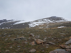
A.k.a. US 34, in Rocky Mountain National Park, Colorado. The road follows this ridge at an elevation of over 10K ft, topping out at Iceberg Pass (11,827 ft/ 3605 m) before dropping down to cross the Continental Divide at Milner Pass. We're obviously above timberline here, and signs exhort people to stay off the tundra (see left inset). Obviously the weather could have been better, but at least the cloud deck was high enough to give some views. I did get into a snow squall, however, a little farther down the road, and a few days before the summer solstice (see right inset)! As it was, the road had just opened--unusually late, as it's usually open for the Memorial Day weekend. In any case, it's a spectacular route, recommended if you're in the area.
20190614 162337 001
| |
|
Forest Canyon Overlook
| |
|
|
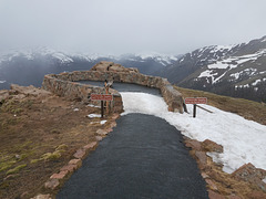
Off Trail Ridge Road (US 34) in Rocky Mountain National Park, at an elevation of 11,716 ft/3571 m (per the USGS 7.5' topo map). The view could have been better today! The signs ask people to stay on the maintained trail to protect the tundra. Looking pretty much west.
20190614 162432 001
| |
|
Off Trail Ridge Road
| |
|
|
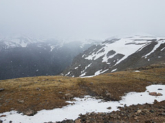
Rocky Mountain National Park, Colorado. The elevation here is about 11,700 ft. And yes, those white blurry objects in the field of view are snowflakes! I'm in a snow squall here.
20190614 163652 001
| |
|
Jump to top
RSS feed- Latest items - Subscribe to the latest items added to this album
- ipernity © 2007-2026
- Help & Contact
|
Club news
|
About ipernity
|
History |
ipernity Club & Prices |
Guide of good conduct
Donate | Group guidelines | Privacy policy | Terms of use | Statutes | In memoria -
Facebook
X


