3-18-19
Folder: unsorted2
Big Box Canyon
East side of the Stillwater Range draining into Dixie Valley, central Nevada. This is one of several spectacular slot canyons along the range front here. The range is being uplifted so quickly (geologically speaking) that erosion hasn't had time to broaden the canyons. The canyons have a rough "wineglass" cross section, with a somewhat wider upper part tapering downward. This is one of the geomorphologic indicators of active faulting!
A "box" canyon traditionally, of course, was one that ended at an unclimbable bluff, and this canyon qualifies there, too. When I was last here in fall 2000, there'd been an aluminum ladder up where that waterfall is, so that (in theory, anyway) you could bypass the cliff, but evidently it washed away in one or another flood over the years. The creek is _not_ generally running like this; it's a result of spring snowmelt in a good year! When I was here before there was no waterfall, just damp rock.
The left inset shows a view of the range front, with this canyon highlighted. The right inset shows a more oblique view, looking back southwesterly, with Little Box Canyon (yes, there is one!) also highlighted. I also tried to embed a video of the flowing waterfall as a PiP, but evidently that doesn't work, so I've posted it separately.
Road to Big and Little Box Canyons
Looking southwesterly from Nevada SR 121 in Dixie Valley toward the Stillwater Range. The range front is defined by an active high-angle fault, with the range being uplifted with respect to Dixie Valley. Big and Little Box Canyons (highlighted) are the most spectacular of several slot canyons that were eroded as the land rose around them. The slope into which they're cut is pretty much the fault plane, little modified by erosion. The fault scarp from the 1954 earthquake is visible here and there along the break in slope defining the range front. See adjacent photos for more information.
The snowcapped peak on the skyline left of center is Job Peak (8785 ft/2678 m). The ragged snowclad multiple summit on the skyline directly above the road is unnamed, according to the 1972 USGS Job Peak 7.5' quadrangle. It's at the north end of a high section of the main ridge crest, and its high point is 8085 ft/2464 m.
Road to Shoshone Pass
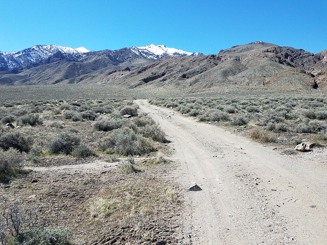
Out the east side of Dixie Valley, Nevada, crossing the Clan Alpine Range. The pass is at the obvious low point to the center-right. The road was in good shape thru here, but had some serious washouts higher up--the high clearance and 4wd was useful! I also saw no other vehicles--my kinda road! It ultimately joins US 50 in the next valley.
Jump to top
RSS feed- Latest items - Subscribe to the latest items added to this album
- ipernity © 2007-2024
- Help & Contact
|
Club news
|
About ipernity
|
History |
ipernity Club & Prices |
Guide of good conduct
Donate | Group guidelines | Privacy policy | Terms of use | Statutes | In memoria -
Facebook
Twitter


