

slgwv's photos
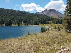
Lower Highland Lake
| |
|
In California's Sierra Nevada west of the main crest, in an inlier in the Carson-Iceberg Wilderness (which means it's accessible by automobile). Judging by the traffic we saw it's a popular fishing area. Looking southwesterly; the prominent peak to the right is Hiram Peak (9795 ft/2986 m). The lake elevation is 8584 ft/2616 m, so the peak is higher than it seems!
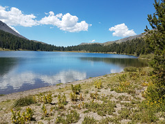
Lower Highland Lake
| |
|
|
|
In California's Sierra Nevada west of the main crest, in an inlier in the Carson-Iceberg Wilderness (which means it's accessible by automobile). Judging by the traffic we saw it's a popular fishing area. The left inset shows a view from the other end of the lake, looking back this way; the right inset is looking directly across that end of the lake. The mountain in that pic is the slope on the left. Our trailhead parking was right near here; we weren't fishing!
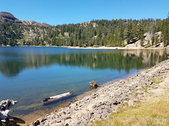
Kinney Reservoir
| |
|
A reservoir off California SR 4 on the east side of the Sierra Crest, in the upper reaches of the drainage of the East Fork of the Carson River. It was built for water storage for agriculture about a century ago. It's now a popular fishing site. Looking northwest.
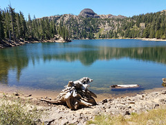
Kinney Reservoir
| |
|
|
A reservoir off California SR 4 on the east side of the Sierra Crest, in the upper reaches of the drainage of the East Fork of the Carson River. It was built for water storage for agriculture about a century ago. It's now a popular fishing site. Looking west; Highway 4 is just off the pic to the left. The inset shows a slightly different view.
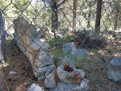
Silver Mountain Jail
| |
|
|
|
Or rather, the ruins thereof--and the only structure of which even ruins remain! Some artifacts have been put on top the slab holding a plaque from E Clampus Vitus (insert, upper right) The plaque (insert, upper left) reads:
"Settled by Scandinavian miners in 1858, then called Kongsberg. Renamed Silver Mountain in 1863 and made county seat of Alpine County Aug. 11th, 1864. During the [18] sixties, the town supported a post office, two newspapers, express office, telegraph office and several hotels. Population was at its peak in 1865. County seat moved to Markleeville Nov. 1st, 1875."
By the late 1850s the original gold strkes on the western slopes of the Sierra Nevada were pretty much played out, and prospectors were fanning out across the rest of California and into what's now Nevada. BTW, Markleeville still exists and remains the county seat--with a population, per Wikipedia, of 210 as of the 2010 census. (Up from 197 in 2000!)
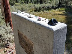
Artifacts, Silver Mountain site
| |
|
On top the concrete slab holding the E Clampus Vitus plaque. Silver Mountain, originally Kongsberg, was an early (late 1850s) silver strike in the easten Sierra Nevada, just off what's now California SR 4 over Ebbetts Pass. See enclosing photo for more information.
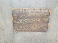
Silver Mountain (Kongsberg) Plaque
| |
|
Courtesy of E Clamus Vitus. A mining camp off California SR 4 east of Ebbets Pass. By the 1850s the original gold strikes in the western slopes of the Sierra Nevada were pretty much played out, and prospectors were fanning out across the rest of California and into what's now Nevada.
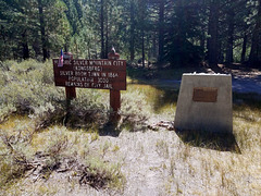
20200809 105626 001 adj
| |
|
20200809 151748 001
| |
|
20200809 151618
| |
|
IMG 0654
| |
|
IMG 0651
| |
|
IMG 0640
| |
|
IMG 0633
| |
|
IMG 0629
| |
|
IMG 0624
| |
|
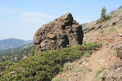
IMG 0619
| |
|
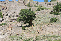
IMG 0615
| |
|
