

slgwv's photos

Bridge, Bizz Johnson Trail
| |
|
Along the old rail line from Susanville to Westwood. It's now a biking/hiking/equestrian trail.

Jill and Jack in the snow
| |
|
|
|

Cole

Jack & Cole
| |
|

Jill running

Moon over Mt. Rose

Bilk Creek reservoir
| |
|
|
|
Humboldt County, Nevada, USA. Probably a CCC (Civilian Conservation Corps) project in the 1930s.

Dry irrigation ditch
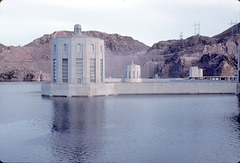
Back of Hoover Dam
| |
|
Penstock towers completely covered! Lake Mead at its all-time high during the flood of 1983.
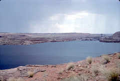
Lake Powell, flood of 1983
| |
|
|
At its all-time highest, looking downstream toward Glen Canyon Dam. Note that the lip of the dam is barely visible, and the bathtub ring is completely gone.
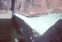
Glen Canyon spillway, flood of 1983
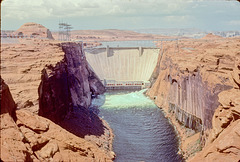
Glen Canyon Dam, flood of 1983
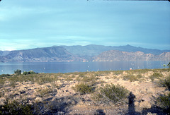
Boulder Basin, flood of 1983
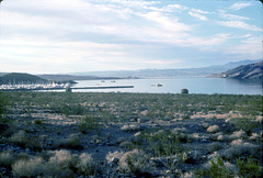
Boulder Beach, flood of 1983
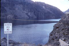
Lake Mead upstream from Hoover Dam
| |
|
At its all-time highest point during the flood of 1983. Note the complete absence of the bathtub ring!
Here's a comparison with conditions as of 2009:
www.ipernity.com/doc/289859/23645531
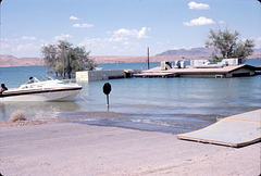
Sunken ranger station, Lake Mead
| |
|
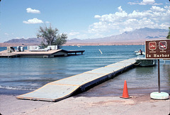
Another view. Note the boat moored to the stop sign! Again, this is Overton Beach during the flood of 1983.
Here's a link to a comparison with how this area looked in 2010:
www.flickr.com/photos/34117538@N08/5449188260/
Sunken ranger station
| |
|
|
At Overton Beach. Flooded to the eaves, summer 1983! The spillways were tested in August 1941, and the water was never expected to get this high again.
Never say never...
EDIT: I incorrectly identified this place as Echo Bay originally. It's in fact a bit farther up the lake.
PS: Here's a link to a compare-and-contrast with Lake Mead's current drought level:
www.ipernity.com/doc/289859/23645513/in/album/455243
Echo Bay, flood of 1983
| |
|
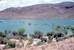
Echo Bay marina off to the left. The campground is flooded; note the line of trees out in the water (including palms up to their fronds)! Outlined.
Here's a link with a comparison to conditions now (2010):
Flood vs. Drought: Echo Bay, Lake Mead, Nevada
