

slgwv's photos

19-overlook_view-6-85_ig_adj
| |
|

18-log_in_ash-6-85_ig_adj
| |
|
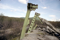
Broken truss bridge
| |
|
|
|
Swept away by the mudflow down the Toutle ("tootle") River in the May, 1980 eruption of Mt. St. Helens, Washington state, USA. Still just lying there like a crushed beer can 5 years later.
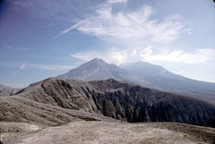
Mt. St. Helens
| |
|
|
|
In June 1985, just over 5 years after the major eruption of May, 1980. Steam is rising from the crater from the new lava dome that has been building, off and on, since the eruption. At this time this was as close as the general public could approach.

15-j&stump2-6-85_ig_adj
| |
|

14-pkg_lot_adj
| |
|

12-spirit_lake-6-85_ig_adj
| |
|
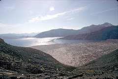
Driftwood in Spirit Lake
| |
|
|
|
From the May 1980 eruption of Mt. St. Helens, Washington state, USA. Spirit Lake was enlarged due to damming by the mudflow when the north side of the mountain blew out. Still 5 years later much of the surface is covered with floating logs.

09-spirit_lake-6-85_ig_adj
| |
|

07-wrecked_car-6-85_ig_adj
| |
|

05-blowdown_in_devastated_area-6-85_ig_a dj
| |
|

03-trees_devastated_area-6-85_ig_adj
| |
|

02-mt_st_helens-6-85_ig_adj
| |
|
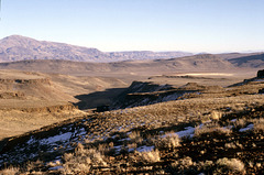
High Desert
| |
|
|
|
Above High Rock Canyon looking southeasterly toward High Rock Lake, which that year was dry. The skylined mountain on the left is Black Mountain (5951 ft/1814 m). This area is now part of the Little High Rock Canyon wilderness, so the road we used to get here is now closed to vehicle traffic. This is northern Washoe County, Nevada, which is as remote an area as still exists anywhere within the contiguous 48 states--despite the fact that it's considered an "urban" county because Reno lies within its southern end! Oh, and yes--that white stuff in the shade is snow!

4-02-valley so low_ig_adj
| |
|
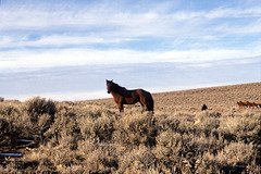
A horse with no name...
| |
|
|
|
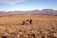
Mustang mare in the vicinity of High Rock Lake, northern Washoe County, Nevada, USA. Map location is as best as I can remember.

3-34-odd canyon_ig_adj
| |
|
3-33-horse2_ig_adj
| |
|
