

slgwv's photos
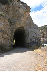
Tunnel, Salina Creek frontage road
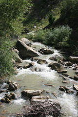
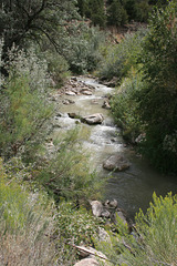
Salina Creek
| |
|
|
|
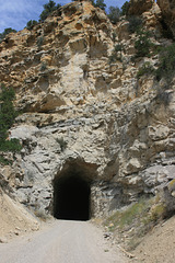
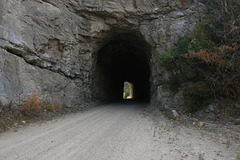
East of Salina, Utah. Interstate 70 follows the canyon containing the creek, heading almost due east on its way over the San Rafael Swell. A good graded frontage road parallels the freeway and the creek, and because of its overall gentle grade it makes a nice mountain bike route from the top of the pass back west toward Salina. It's more fun than the freeway! There are even a couple of short tunnels on the frontage road (inserts). "Salina" is locally pronounced with a long "i", btw.
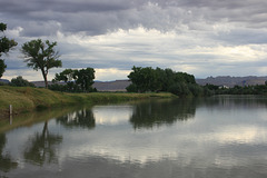
Green River
| |
|
|
|
In the eponymous state park in the eponymous town, Utah. The buildings are in the town--it's a small settlement right on I-70. Altho there is still a bit of irrigation agriculture in the area, the economy now mostly depends on the freeway. Looking upstream; the inset shows the downstream view, with the railroad bridge in the distance.

Green River
| |
|
|
Downstream view from the state park. The bridge is for the railroad, now the Union Pacific, but originally the Denver & Rio Grande. From Green River the railroad goes northwesterly, more or less along US 191, to Price, Utah, whereas I-70 goes straight west across the San Rafael Swell.
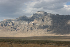
Notch Peak
| |
|
|
|
High point (9654 ft/2943 m) of the House Range, in the Basin & Range of western Utah. Looking north from Highway 6-50. The cliffs are composed of metamorphosed limestone from cooking by a granite body, the edge of which is just visible on the skyline at left (the pinkish outcrops). Somewhere I saw it asserted that the cliffs here are the tallest in the Great Basin, but I haven't been able to track that claim down. I did a bunch of field work here back in the late 70s. Contact metamorphism of a limestone is a classic setting for tungsten mineralization, so there was a big network of prospecting roads coming in from the east side, which led to better access than you might expect. Dunno whether they're all shut off now, tho--
IMG 0861
| |
|

IMG 0857
| |
|
IMG 0855
| |
|
Tunnel, Salina Creek frontage road
| |
|
Looking back eastward (uphill) at the more westerly of two short tunnels on this frontage road. Utah, USA.
Tunnel, Salina Creek frontage road
| |
|
The more westerly of two short tunnels on this frontage road. Looking west (downhill).
IMG 0209
| |
|
IMG 0205
| |
|
IMG 0204
| |
|
IMG 0192
| |
|
IMG 0191
| |
|
Unnamed
| |
|
|
|
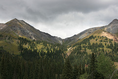
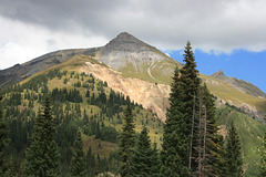
Sub-peak looming over the Red Mountain mining district to the west, Colorado. If I'm reading the USGS topo map correctly, the elevation is 13359 ft (4072 m). Yes, we're in the Rockies here--in the San Juan Mountains, to be exact. There are a couple of small snow patches still visible.
IMG 0189
| |
|
IMG 0188
| |
|
