

slgwv's photos
IMG 9758
| |
|
IMG 9757
| |
|
IMG 9751
| |
|
IMG 9740
| |
|
IMG 9735
| |
|
IMG 9734
| |
|
IMG 9721
| |
|

IMG 9713
| |
|
IMG 9706
| |
|
IMG 9704
| |
|
IMG 9700
| |
|
IMG 9693
| |
|
Tahquitz Rock
| |
|
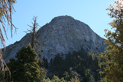
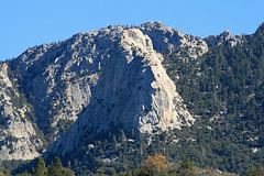
Looking at the north face from just above the trailhead parking lot. The easier routes are off to the right, behind the tree in the foreground. You have to scramble up that pine-covered slope below just to get to the climbing!
Tahquitz Rock
| |
|
|
|
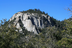
TAH-keets, after a malevolent spirit in local Native American lore. (Perversely labeled "Lily" Rock on the USGS topo map, but no one--at least in the climbing fraternity--calls it that!) Located in the San Jacinto Mountains of southern California, it's the historical heart of rock climbing in SoCal, with named routes going back to the 30s. I did some climbing (on the easier routes) here in the early 70s, as part of a college club. The inset shows a (shaded) view of the north-facing side, with the easier routes off to the right edge of the pic. All the routes start with a scramble up the slope in the foreground! So you'd usually wear regular hiking boots to start, and change into the climbing shoes at the base of the rock.
The location is of the rock itself, rather than the photo point.
IMG 9670
| |
|

IMG 9667
| |
|
IMG 9659
| |
|

IMG 9647
| |
|
