

slgwv's photos
20190522 133814 001
| |
|
20190522 133606 001
| |
|
20190522 131752 001
| |
|
20190522 131744 001
| |
|
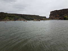
20190522 130432 001
| |
|
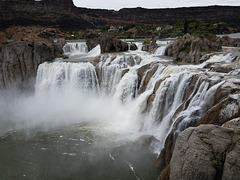
Shoshone Falls
| |
|
|
|
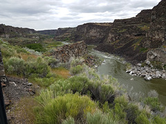
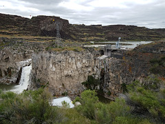
On the Snake River in southern Idaho. A gray day, but the falls are in fine form! Later in the season they often go dry because of upstream diversions for irrigation. Some water is also diverted for hydropower, in an installation off the pic to the left (inset).
Shoshone Falls lies in the spectacular Snake River Gorge, which was scoured and deepened around 18K years ago by the so-called Bonneville Flood. Lake Bonneville, an enormous Pleistocene lake covering much of western Utah, overtopped Red Rock Pass in southern Idaho and started spilling into the Snake drainage. The material where the overflow occurred was loose ("unconsolidated", in the jargon) and started eroding very quickly, to yield the natural equivalent of a dam failure. The top few hundred feet of Lake Bonneville spilled out this way in a matter of a few weeks! Geomorphological evidence indicates that at peak flow the gorge was completely filled brim to brim.
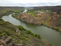
Snake River Canyon
| |
|
|
|
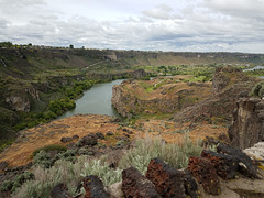
Twin Falls, Idaho. Looking downstream (west) from near the southern end of the I.G. Perrine (US Highway 93) bridge. I thought the golf course nestled improbably amongst the craggy outcrops was an interesting touch! As I've noted elsewhere, this canyon was scoured and deepened about 18K years ago by the so-called Bonneville Flood, when Pleistocene Lake Bonneville overtopped a drainage divide into the Snake's drainage basin. The resulting rapid downcutting led to the natural equivalent of a dam failure. Lake Bonneville covered much of western Utah (the Great Salt Lake is a highly shrunken remnant), and it suddenly lost the top few hundred feet of water depth as a result of the flood. Geomorphological evidence indicates that at peak flow this canyon was filled brim to brim.
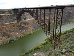
I.B. Perrine Bridge
| |
|
|
|
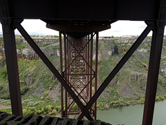
Carrying U.S. 93 across the Snake River Gorge from Twin Falls, Idaho. Looking north from Twin Falls. The insets show (left) a view of the bridge from the north and upstream side, looking back toward Twin Falls; and (right, below) a view under the bridge from the north side looking south. This inset is positioned at that viewpoint. Perrine was a prominent early settler and promoter. Downstream is to the left.

20190522 113024
| |
|

Frank
| |
|
|
|
Our new black tricolor. I went all the way to Twin Falls, Idaho (~400 miles) to pick him up at the animal shelter there! But so far he's fitting in fine. "Frank" is the shelter's name, but we didn't have any better ideas so we're keeping it.
20190522 112759 001
| |
|
Under the bridge
| |
|
|
Perrine Bridge, carrying US 93 across the Snake River Gorge, looking back south toward the city of Twin Falls, Idaho. Downstream is to the right.

Perrine Bridge
| |
|
|
Carrying US 93 across the Snake River Canyon at Twin Falls, Idaho. Twin Falls is the city on the far side. Looking south; downstream is to the right.

20190522 112240 001
| |
|

20190522 084846
| |
|

IMG 7157
| |
|
IMG 7156
| |
|
IMG 7153
| |
|
