

Pedrocut's photos

Llyn Padarn and former Dinorwig slate mine, Llanbe…

Llanberis Pass. (Scan from c1990)

Llanberis Pass. (Scan from c1990)

Llanberis Pass. (Scan from c1990)

Llyn peris and Former Dinorwig slate mine Llanberi…

Nant Ffrancon valley, Snowdonia from the A5. (Scan…

Dolbadarn Castle, at the base of the Llanberis Pas…
| |
|
Dolbadarn Castle, at the base of the Llanberis Pass. (Scan from c1990)
Grade I Listed Building.

A4069 Black Mountain Road, on the western Brecon B…
| |
|
A4069 Black Mountain Road, on the western Brecon Beacons, possibly on or just below the Black Mountain Pass.
(Scan from c1990)

A4069 Black Mountain Road, on the western Brecon B…
| |
|
A4069 Black Mountain Road, on the western Brecon Beacons, possibly on or just below the Black Mountain Pass.
(Scan from c1990)

Capel Curig Lakes. (Scan from c1990)

Llanthony Priory, Vale of Ewyas. (Scan from c1990)
| |
|
|
|
Llanthony Priory, Vale of Ewyas.
(Scan from c1990)
The Priory is a Grade I listed Building, partly ruined former Augustinian priory in the secluded Vale of Ewyas, a steep-sided once-glaciated valley within the Black Mountains area of the Brecon Beacons National Park in Monmouthshire, south east Wales.

Lord Hereford's Knob (Twmpa), Black Mountains

Junction of Mott’s Road & the Port Way, Long Mynd.…

Nearing Little Stretton from the descent from Cros…
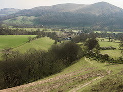
Looking over Little Stretton from the slopes of Ca…
| |
|
Looking over Little Stretton from the slopes of Callow with Ragleth Hill in the distance. (Scan from January 1990)

Looking along Cowside Beck from the road from Arnc…

RAF Fylingdales. (Scan from c1990)
| |
|
|
|
RAF Fylingdales.
Situated high on Snod Hill, between Pickering and Whitby, about 4 miles north-west of Goathland.
The original Cold War installation, operational from 1963 until the early 1990s. It was part of the Ballistic Missile Early Warning System (BMEWS), jointly operated by the RAF and the US Air Force.
In 1992, the domes were dismantled and replaced by the current tetrahedral “pyramid” building, which houses advanced phased-array radar panels.

