


Death Valley

Folder: United States
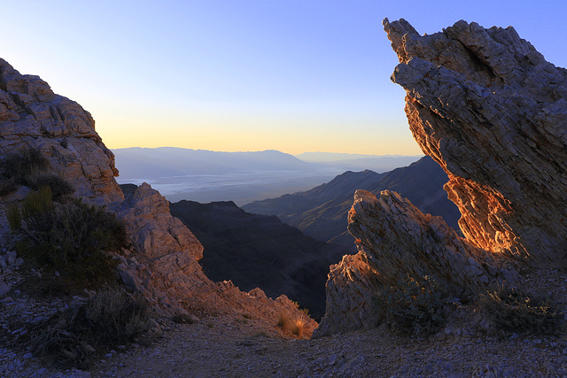

Sunrise at Aguereberry Point
We are home again after driving 1300 miles straight through from southern California. We had intended to to some sightseeing along the way but the weather was awful with snow in the mountains and lots of rain. I have nearly 2000 photos to sort through and get ready for posting as well and may be posting some other things until I have time to go through them but thought I'd post this to whet everyone's appetite.
In spite of the bad weather we had while traveling we had two and half wonderful days at Death Valley National Park and this was one of the first photos I took. We left the Los Angeles area early Thursday morning, March 2, and drove to Auguereberry Point in the mountains on the west side of the park, arriving while it was still dark and sleeping for a few hours before sunrise.
02 Mar 2017
35 favorites
23 comments
Sunrise at Aguereberry Point
Having driven to southern California Monday and Tuesday, February 27 and 28, and having taken care of my business on Wednesday, March 1, we left for Death Valley National Park very early on Thursday morning. We arrived at our intended destination, Aguereberry Point, long before daybreak and slept for several hours in the back of our van. Daybreak was time for photos and we stayed there for our breakfast as well. This view looks northeast from the point which is in the western mountains of DVNP and is named for Pete Aguereberry, a prospector who worked in the area for many years and who built the first road into the area.
02 Mar 2017
35 favorites
24 comments
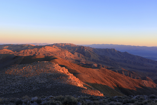
Aguereberry Point
This was taken nearly as far out on Aguereberry Point as we were able to go and looks to the south. it was an incredible view to begin our two day's visit to Death Valley National Park. Aguereberry Point is in the mountains west of Death Valley and is at an elevation of 6433 feet. Over the course of the day we would descend to the lowest point in North America at Badwater (279 feet below sea level) and then up again to 5476 feet at Dante's View in the mountains east of Death Valley.
02 Mar 2017
27 favorites
21 comments
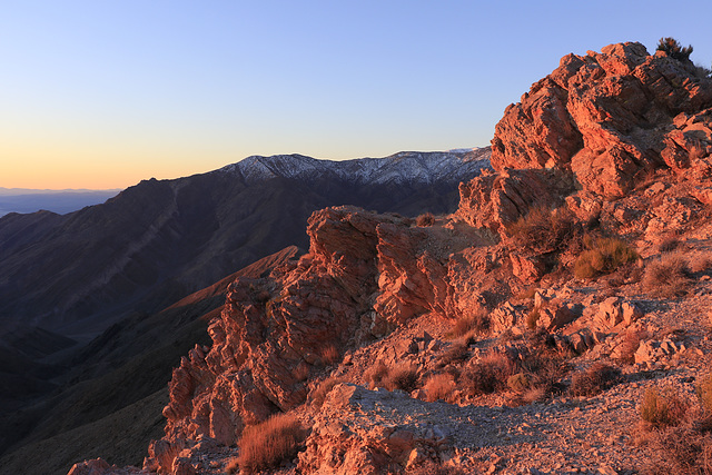
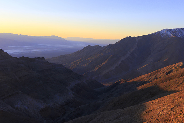
Death Valley Sunrise
One more photo taken from Aguereberry Point in Death Valley National Park. We had driven through the night to this secluded spot and waited for the sunrise before going on to other areas of the park. The view is south over Badwater, the lowest area in North America.
02 Mar 2017
18 favorites
19 comments
Home Away from Home
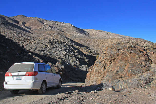
This was taken by my wife on the dirt road from Aguereberry Point in Death Valley National Park where we had watched the sunrise. This road was very rough in spots and one of the worst areas was just ahead of where the photo was taken. There was no one else around and so we felt safe stopping in the road for some photos. We would go on a few miles to the now abandoned Eureka Mine and nearby camp. The van is not only our transportation but our home away from home. My wife has made curtains for the inside and we use the deck for sleeping - we use our backpacking pads and sleeping bags and are comfortable and warm. We have our tiny backpacking stove along for meals and hot drinks.
02 Mar 2017
31 favorites
19 comments
Eureka Gold Mine
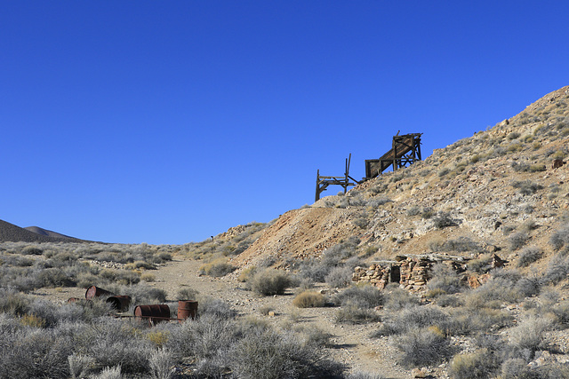
The Eureka Mine was worked by a Basque immigrant named Pete Aguereberry from 1907 to 1930. The mine produced ore assaying at $500 to the ton. The photo shows the hillside near the mine with the ruins of an old stone structure at the base of the hill, the remains of the ore crusher on the side of the hill, and various debris from the mining operation scattered around. The abandoned camp or town, named Harrisburg, is on the other side of the hill.
02 Mar 2017
24 favorites
22 comments
Aguereberry Camp
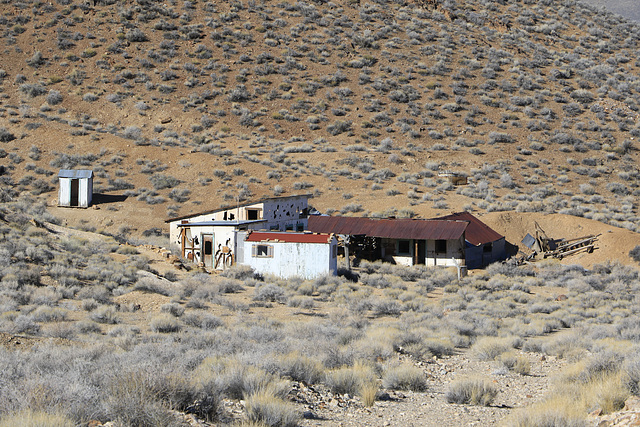
Also known as Harrisburg or Harrisberry, this was the camp from which the Eureka Mine was worked. Pete Aguereberry had his own cabin here from 1907 to 1945 and there was guest cabin as well. After exploring the mine we also explored the camp, now long abandoned and falling to pieces.
02 Mar 2017
30 favorites
24 comments
Ready to Ride
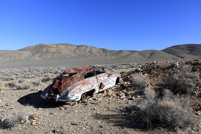
This abandoned car lies near Aguereberry Camp and Eureka Mine on the west side of Death Valley National Park. I do not know what kind of car it is, but it has certainly seen better days.
02 Mar 2017
27 favorites
17 comments
Emigrant Canyon
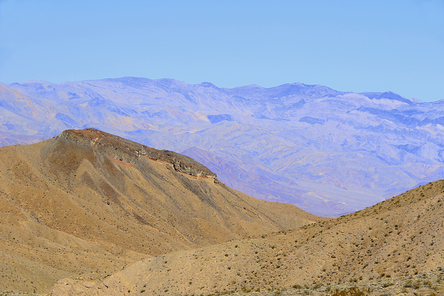
Emigrant Canyon runs north and south through the Panamint Mountains on the west side of Death Valley National Park. It drops from over 5000 feet to sea level through a winding canyon and along a dangerous winding road. This view is north from along the road and near its end.
Jump to top
RSS feed- Latest items - Subscribe to the latest items added to this album
- ipernity © 2007-2026
- Help & Contact
|
Club news
|
About ipernity
|
History |
ipernity Club & Prices |
Guide of good conduct
Donate | Group guidelines | Privacy policy | Terms of use | Statutes | In memoria -
Facebook
X
