Shooting information for this photo
← Back to the photo page
Want to know more about EXIF?
Check wikipedia page about Exchangeable image file format (EXIF)
Check wikipedia page about Exchangeable image file format (EXIF)
Some of EXIF data are only available in English.
| Camera: | Canon EOS 5D Mark III |
|---|---|
| Exposure: | 0.0025 sec. (1/400) |
| Aperture: | f/2.8 |
| Focal Length: | 24.0 mm (35 mm equivalent: 44.8 mm) |
| Flash: | No Flash |
| Exposure mode: | Aperture-priority AE |
| Max Aperture: | 2.8 |
| Resolution: | 240 x 240 dpi |
| Original Date: | 2013:09:03 12:58:30.00 |
| Created on: | 2013:09:03 12:58:30.00 |
| Modified on: | 2013:09:14 22:30:29 |
| Software: | Adobe Photoshop Lightroom 5.0 (Windows) |
| Artist | Ken Fox |
| Circle Of Confusion | 0.016 mm |
| Color Space | sRGB |
| Compression | JPEG (old-style) |
| Creator | Ken Fox |
| Custom Rendered | Normal |
| Date/Time Created | 2013:09:03 12:58:30 |
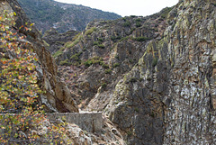
| Description | Route 180 is carved into the side of Kings Canyon. Many sections with sheer, blasted cliff on one side and steep drop-off on the other. |
| Device Mfg Desc | IEC http://www.iec.ch |
| Device Model Desc | IEC 61966-2.1 Default RGB colour space - sRGB |
| Digital Creation Date/Time | 2013:09:03 12:58:30 |
| Exif Version | 0230 |
| Exposure Compensation | 0 |
| Exposure Mode | Auto |
| Field Of View | 43.8 deg |
| Focal Plane Resolution Unit | mm |
| Focal Plane X Resolution | 160 |
| Focal Plane Y Resolution | 160 |
| Format | image/jpeg |
| Hyperfocal Distance | 12.78 m |
| ISO | 100 |
| Image Description | Route 180 is carved into the side of Kings Canyon. Many sections with sheer, blasted cliff on one side and steep drop-off on the other. |
| Image Size | 3085x2057 |
| Interoperability Index | R98 - DCF basic file (sRGB) |
| Interoperability Version | 0100 |
| Lens Info | 24-70mm f/? |
| Lens Model | EF24-70mm f/2.8L II USM |
| Light Value | 11.6 |
| Metadata Date | 2013:09:14 22:30:29-07:00 |
| Metering Mode | Multi-segment |
| Rating | 3 |
| Recommended Exposure Index | 100 |
| Resolution Unit | inches |
| Scale Factor To 35 mm Equivalent | 1.9 |
| Scene Capture Type | Standard |
| Sensitivity Type | Recommended Exposure Index |
| Sub Sec Time Digitized | 00 |
| Sub Sec Time Original | 00 |
| Subject | CA, California, Kings Canyon, Kings Canyon National Park, coast, post:slug=20130910-yoskcseqpc2 013, post:title=Road Trip 2013: Yosemite |
| Thumbnail Offset | 1446 |
| Title | Route 180 |
| White Balance | Auto |
| XMP Toolkit | Image::ExifTool 9.27 |
GPS Information |
|
| GPS Altitude | 1359.2 m Above Sea Level |
| GPS Altitude Ref | Above Sea Level |
| GPS Date Stamp | 2013:09:03 |
| GPS Date/Time | 2013:09:03 20:05:49.506Z |
| GPS Dest Bearing | 0 |
| GPS Dest Distance | 0 |
| GPS Differential | No Correction |
| GPS Dilution Of Precision | 0.7 |
| GPS Img Direction | 65535 |
| GPS Latitude | 36 deg 49' 25.04" N |
| GPS Latitude Ref | North |
| GPS Longitude | 118 deg 50' 1.64" W |
| GPS Longitude Ref | West |
| GPS Map Datum | WGS-84 |
| GPS Measure Mode | 2-Dimensional Measurement |
| GPS Position | 36 deg 49' 25.04" N, 118 deg 50' 1.64" W |
| GPS Satellites | 9 |
| GPS Speed | 0 |
| GPS Status | Measurement Active |
| GPS Time Stamp | 20:05:49.506 |
| GPS Track | 0 |
| GPS Version ID | 2.3.0.0 |
Jump to top
- ipernity © 2007-2024
- Help & Contact
|
Club news
|
About ipernity
|
History |
ipernity Club & Prices |
Guide of good conduct
Donate | Group guidelines | Privacy policy | Terms of use | Statutes | In memoria -
Facebook
Twitter
