Victoria and Tasmania, amazing states in Australia
The passed years one of my most amazing journeys was a tour through Australians states Victoria and Tasmania.
I was asked why I didn't posted my captures yet by Ipernity? I did the trip in February 2006 - long time already passed.
My time working on my albums by Ipernity is limited and so many other albums I couldn't start, but this set I will not detain:
I like to start now with the breathtaking…
(read more)
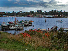
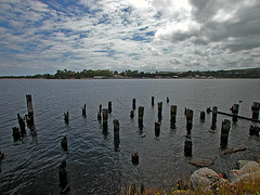
In the bay of Strahan
| |
|
Strahan is located on a spectacularly beautiful harbor and it seems at the end of the world.
Strahan, pronounced "straw-n"
| |
|
... is a small town on our way to the west coast of Tasmania and was intended for our sightseeing flight over the Cradle Mountains. The bad weather conditions over the mountains brought us to stay longer in the town - waiting for a good improvement in the weather.
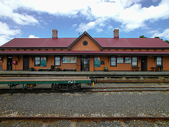
Railway station in Strahan
| |
|
|
|
This station isn't used very much for rail traffic but is still an attraction to visit. The nostalgic West Coast Wilderness Railway starts to Queensland and Zeehan in West Tasmania.
Hellyer River
| |
|
The river has its name from Henry Hellyer (1790-1832), an English surveyor and architect who was one of the first explorers to visit the rugged interior of the north west of Tasmania, and made the most comprehensive maps of the area up to that time.
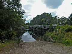
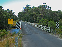
Crossing the Hellyer River
| |
|
A number of walking tracks along the banks of the Hellyer River provide a pleasant walk to refresh before journeying on.
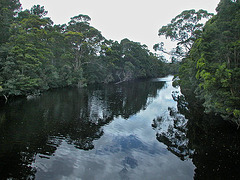
Hellyer River and the Gorge
| |
|
The Hellyer Gorge is a gorge in Tasmania, through which flows the Hellyer River, named after Henry Hellyer. It is the subject of the Hellyer Gorge State Reserve. The Murchison Highway passes through the area with many sharp and steep bends. Being subject to 'black ice', this portion of road has now been bypassed by the newer Ridgely Highway. Nevertheless, the area is quite picturesque.
Lake Mackintosh
| |
|
|
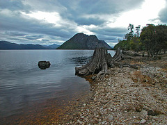
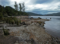
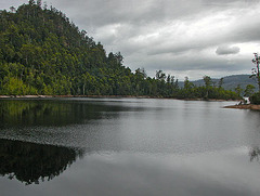
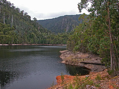
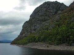
Lake Mackintosh is a long lake running north-south past Mt Farrell, adjacent to the town of Tullah.
Lake Mackintosh
| |
|
At the lakeside camping, canoeing and fishing are free, but you will need a licence to fish for trout in Tasmania’s lakes. A marvelous place!
Lake Mackintosh
| |
|
Like all Hydro Tasmania lakes, Lake Mackintosh is stocked with plump trout. We spent the whole day with a picnic and barbecue on the shore.
Lake Mackintosh
Lake Mackintosh other side
| |
|
Although the lake is an hydro man-made lake, it lies idyllic in the natures landscape.
On the way to Lake Mackintosh
| |
|
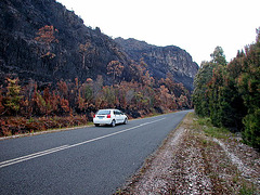
On the left side of the road great firestorms destroyed 3,500 hectare of the forest, just some days ago.
The Tasmanian Fire Service was attending to a fire that continues to burn in the Lake Mackintosh area.
Cradle Mountain
| |
|
The mountain is a mountain in the Cradle Mountain-Lake St Clair National Park in Tasmania. Rising to 1,545 metres above sea level it is one of the principal tourist sites, owing to its natural beauty. The mountain is composed of dolerite columns, similar to many of the other mountains in the area.
Unfortunately the heavy weather conditions forced us to return back to our overnight motel in Rosebery.
Cradle Mountain
| |
|
The clouds often hanging in this mountain range, just some kilometers to the south in Strahan the weather got better and the clouds opened to see the blue sky.
A scheduled sightseeing-flight with a plane started from Strahan we cancelled due the dark clouds over the Mountains.
Walking in the Cradle Mountain in heavy weather
| |
|
The area around the mountain has a large number of day walks, as well as being one terminus of the Overland Track. The mountain is frequently climbed by tourists, virtually year round. It is a strenuous (recommended allotted time: 6.5 hours) return hike from the Dove Lake car park.
We just walked for maybe three hours before the weather got dark and rainy more and more. Our program to have a sightseeing flight over the mountain we gave up due no improvement in the weather was to expect the next few days.
To the Cradle Mountain National Park
| |
|
Is this still the living space for the Tasmanian Tiger? Some local people told us that there people still found some footprints from this exotic animal which is known as being extinct 1936.
(Apropos the Tassi Tiger never was/is a tiger but a wolf which was known as very gentle, not aggressive.)
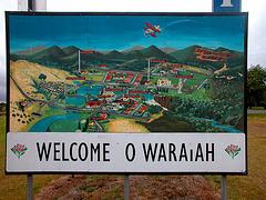
Welcome to Waratah
| |
|
Waratah is a town in western Tasmania. It was constructed to support a tin mine at Mount Bischoff. The town is built at the top of a waterfall, and water was diverted from the stream to provide water for mine sluicing and processing.
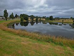
Lake Waratah
| |
|
The town of Waratah is built around the shoreline of Lake Waratah. It is pleasant central point in the town with picnic and barbecue facilities and walks to the falls (just north of Smith Street) and the dam wall near William Street. Make sure to go over the road and inspect the Waratah Falls and the waterwheel.
The mine operated successfully at first. The easy ore was all extracted by 1893 when sluicing was discontinued. Mining continued opencut on the face of the mountain, and underground.
Jump to top
RSS feed- Latest items - Subscribe to the latest items added to this album
- ipernity © 2007-2024
- Help & Contact
|
Club news
|
About ipernity
|
History |
ipernity Club & Prices |
Guide of good conduct
Donate | Group guidelines | Privacy policy | Terms of use | Statutes | In memoria -
Facebook
Twitter

