Climbing Bechervaise
Midnight sun through Weasel Gap
Looking further south from Mt Lacey
Moving again
Weather closing in
Blizzard aftermath
Merry 66 Xmas
Digging out #2
Digging out #1
Ghost of Christmas (long) past
South of Mount Lacey
Away!
Arrival at PCM Nov 1966
Balloon away
Prince Charles Mtns Panorama
North past nunataks
All about maps
Mt Bechervaise
Location
See also...
Keywords
Authorizations, license
-
Visible by: Everyone -
All rights reserved
-
362 visits
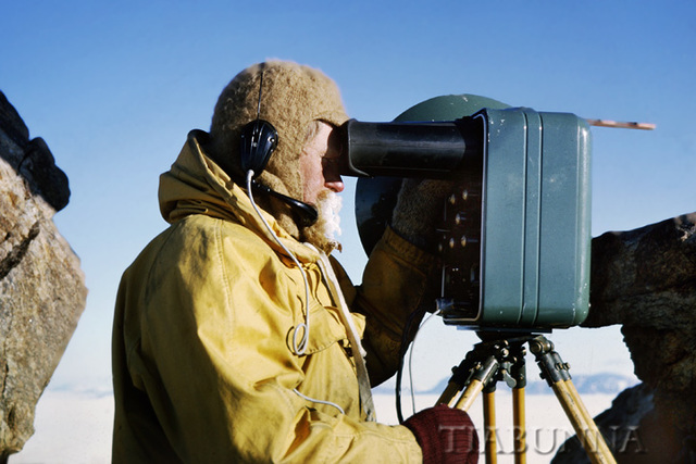
Surveying on Mt Lacey


From an old slide. On Mt Lacey in the Prince Charles Mountains we erected a trig point and took readings of distance and bearings to a field party travelling to other peaks in the area (the machine is a Tellurometer for measuring distance very accurately - something like half a radar set, one was required at each end of the link). The distant mountain range is about 30km away.
Frans Schols, , Gillian Everett have particularly liked this photo
- Keyboard shortcuts:
Jump to top
RSS feed- Latest comments - Subscribe to the comment feeds of this photo
- ipernity © 2007-2024
- Help & Contact
|
Club news
|
About ipernity
|
History |
ipernity Club & Prices |
Guide of good conduct
Donate | Group guidelines | Privacy policy | Terms of use | Statutes | In memoria -
Facebook
Twitter

Sign-in to write a comment.