North past nunataks
Blizzard aftermath #2
Prince Charles Mtns Panorama
The "Nella Dan" returns.
Balloon away
Arrival at PCM Nov 1966
Surveying on Mt Lacey
Climbing Bechervaise
Midnight sun through Weasel Gap
Looking further south from Mt Lacey
Moving again
Another blow
Weather closing in
VW "Antarctica 3" heading across sastrugi
Blizzard aftermath
Adelie penguins
Up and away
Getting them out
Mawson gets a radar
Merry 66 Xmas
Back to Mawson
Visiting Adelie and Emperor penguins
Digging out #2
Digging out #1
Around in East Bay
Ghost of Christmas (long) past
Why did we stop?
Aurora Australis to the SE
Aurora australis over Mawson
Snowtrac on the slope
Icy abstract
Climbing to the plateau
Spring Tripping
From Mt Twintops
Blizz'd in
Rolling past Depot Peak
Late evening running
On Peak 7
Final stop for the main tractor trains
Midnight Sun
Nella Dan departure for Antarctica, Dec 1965, Melb…
Through the blizzard
Mt Bechervaise
Up to the plateau from Mawson
Pre-heating the Polaris
Heading away
Trig point on Peak 7
Travelling past sunset
Rolling past Depot Peak
Blizz'd In
Spring tripping
Cold run
View from Mt Twintops
Looking across to Mt Hordern
Antarctica 3 at the Central Masson Ranges
Regal visit
Snowtrac on the slope
Nacreous Clouds
Nacreous Clouds at sunset
Vehicles at Mawson
The Mawson bar
Midwinter dinner
Dog teams on the sea ice
Snowtrac near Mt Henderson
Dog team passing iceberg
View from the office window
Meet Orhog
Aurora australis over Mawson
Aurora Australis to the SE
Aurora over Mawson Station
Daily water run
Field hut at Fischer Nunatak
Mixed transport at Painted Peak
Weddell seal
To Rumdoodle by VW
Reflective hub cap
Pancake ice
Visiting Adelie penguins
Through Mawson after an early snowfall
View to the north
Snow drifting off the plateau
Nella in the morning!
DUKW going ashore
Arriving at Mawson Station
Strawberry ice cream?
Sea ice sunset
Ross Seal
Crabeater Seals
One of the first icebergs
Into the pack ice
From one extreme to another
Location
See also...
Keywords
Authorizations, license
-
Visible by: Everyone -
All rights reserved
-
337 visits
All about maps


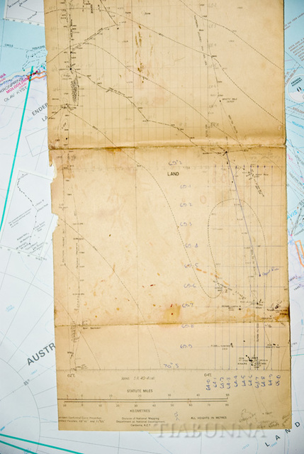
I've rummaged through old papers and found this route map we used during our 1966 trip. The mountains had been aerially photographed in the 1950s-early 60s: our job was to accurately map their locations. The insert on the newer background map (1989) shows our route and the peaks mapped
- Keyboard shortcuts:
Jump to top
RSS feed- Latest comments - Subscribe to the comment feeds of this photo
- ipernity © 2007-2024
- Help & Contact
|
Club news
|
About ipernity
|
History |
ipernity Club & Prices |
Guide of good conduct
Donate | Group guidelines | Privacy policy | Terms of use | Statutes | In memoria -
Facebook
Twitter

Sign-in to write a comment.