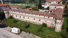
Shooting information for this photo
← Back to the photo page
Want to know more about EXIF?
Check wikipedia page about Exchangeable image file format (EXIF)
Check wikipedia page about Exchangeable image file format (EXIF)
Some of EXIF data are only available in English.
| Camera: | DJI FC7203 |
|---|---|
| Exposure: | 0.0008 sec. (1/1250) |
| Aperture: | f/2.8 |
| Focal Length: | 4.5 mm (35 mm equivalent: 24.0 mm) |
| Flash: | No flash function |
| Exposure mode: | Program AE |
| Max Aperture: | 2.8 |
| Resolution: | 72 x 72 dpi |
| Dimension: | 4000 x 2250 pixels |
| Compression: | 3.433720889 bits/pixels |
| Original Date: | 2020:09:12 12:12:55 |
| Created on: | 2020:09:12 12:12:55 |
| Software: | v02.51.0008 |
| About | DJI Meta Data |
| Absolute Altitude | +45.30 |
| Already Applied | False |
| Cam Reverse | 0 |
| Circle Of Confusion | 0.006 mm |
| Color Space | sRGB |
| Components Configuration | -, Cr, Cb, Y |
| Compression | JPEG (old-style) |
| Contrast | Normal |
| Custom Rendered | Normal |
| Digital Zoom Ratio | undef |
| Exif Version | 0230 |
| Exposure Compensation | 0 |
| Exposure Index | undef |
| Exposure Mode | Auto |
| Field Of View | 73.7 deg |
| File Source | Digital Camera |
| Flashpix Version | 0010 |
| Flight Pitch Degree | +3.40 |
| Flight Roll Degree | -2.90 |
| Flight Yaw Degree | -42.10 |
| Focal Length In 35mm Format | 24 mm |
| Format | image/jpg |
| Gain Control | None |
| Gimbal Pitch Degree | -19.30 |
| Gimbal Reverse | 0 |
| Gimbal Roll Degree | +0.00 |
| Gimbal Yaw Degree | +2.20 |
| Has Crop | False |
| Has Settings | False |
| Hyperfocal Distance | 1.28 m |
| ISO | 100 |
| Image Description | DCIM\100MEDIA\DJI_0007.JPG |
| Image Size | 4000x2250 |
| Interoperability Index | R98 - DCF basic file (sRGB) |
| Interoperability Version | 0100 |
| Light Source | Fluorescent |
| Light Value | 13.3 |
| Metering Mode | Center-weighted average |
| Relative Altitude | +15.60 |
| Resolution Unit | inches |
| Saturation | Normal |
| Scale Factor To 35 mm Equivalent | 5.3 |
| Scene Capture Type | Standard |
| Scene Type | Directly photographed |
| Sharpness | Normal |
| Subject Distance | 0 m |
| Subject Distance Range | Unknown |
| Thumbnail Offset | 18432 |
| Version | 7.0 |
| White Balance | Auto |
| XP Comment | Type=N, Mode=P, DE=None |
| XP Keywords | v02.51.0008;0.0.1;v1.0.0 |
| Y Cb Cr Positioning | Centered |
GPS Information |
|
| GPS Altitude | 45.2 m Above Sea Level |
| GPS Altitude Ref | Above Sea Level |
| GPS Latitude | 45 deg 21' 24.20" N |
| GPS Latitude Ref | North |
| GPS Longitude | 9 deg 55' 53.06" E |
| GPS Longitude Ref | East |
| GPS Position | 45 deg 21' 24.20" N, 9 deg 55' 53.06" E |
| GPS Version ID | 2.3.0.0 |
Jump to top
- ipernity © 2007-2024
- Help & Contact
|
Club news
|
About ipernity
|
History |
ipernity Club & Prices |
Guide of good conduct
Donate | Group guidelines | Privacy policy | Terms of use | Statutes | In memoria -
Facebook
Twitter
