Coastal
Photos taken at or near the coast.
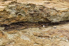
Benacre Cliffs - Norwich Crag bioturbated clay wit…
| |
|
Benacre Cliffs, just north of Covehithe in Suffolk, are comprised of cross-bedded sands and gravels of the Westleton Formation, with beds of bioturbated clay; part of the Norwich Crag, early Pleistocene in age. Here, a fossil tree branch can be seen in the clay. 20p coin for a scale.
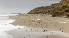
Looking towards Southwold from Benacre Cliffs
| |
|
Benacre Cliffs, just north of Covehithe in Suffolk, are comprised of cross-bedded sands and gravels of the Westleton Formation, with beds of bioturbated clay; part of the Norwich Crag, early Pleistocene in age.
This stretch of coast line is currently experiencing the most active coastal erosion in the UK, with average loss rates of around 7 metres per year. The cliffs are only recently formed and are growing in height. The land behind the cliff line is a gentle hill, therefore as the sea eats into the cliff line causing it to retreat westwards into the hillside, so the top of the cliff gets higher.
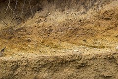
Benacre Cliffs cross-bedded gravels 2
| |
|
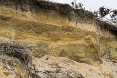
Cross-bedded sands and gravels underlain by bioturbated sandy clay. Westleton Formation; part of the Norwich Crag (early Pleistocene) at Benacre Cliffs, just north of Covehithe in Suffolk. Above the cross-bedded unit, blown sand merges into modern soil.
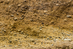
Benacre Cliffs cross-bedded gravels 1
| |
|
Detail of cross-bedded sands and gravels of the Westleton Formation; part of the Norwich Crag (early Pleistocene) at Benacre Cliffs, just north of Covehithe in Suffolk.
Collapsed pill box at Benacre Cliffs
| |
|
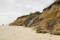
Benacre Cliffs, just north of Covehithe in Suffolk, are comprised of cross-bedded sands and gravels of the Westleton Formation, with beds of bioturbated clay; part of the Norwich Crag, early Pleistocene in age.
This stretch of coast line is currently experiencing the most active coastal erosion in the UK, with average loss rates of around 7 metres per year. The cliffs are only recently formed and are growing in height. The land behind the cliff line is a gentle hill, therefore as the sea eats into the cliff line causing it to retreat westwards into the hillside, so the top of the cliff gets higher. The collapsed WW2 pill-box illustrates the erosion process.
Benacre Cliffs - Westleton Formation
| |
|
Benacre Cliffs, just north of Covehithe in Suffolk, are comprised of cross-bedded sands and gravels of the Westleton Formation, with beds of bioturbated clay; part of the Norwich Crag, early Pleistocene in age.
This stretch of coast line is currently experiencing the most active coastal erosion in the UK, with average loss rates of around 7 metres per year. The cliffs are only recently formed and are growing in height. The land behind the cliff line is a gentle hill, therefore as the sea eats into the cliff line causing it to retreat westwards into the hillside, so the top of the cliff gets higher.
Rhossili Bay - classic view
| |
|
|
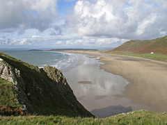
The obligatory viewpoint for Rhossili Bay, taken on a bright but blusterous, showery, autumn day.
Looking northwards towards Burry Holms. Llansteffan and Pendine Sands visible in the far distance.
Devil's Bridge - Worm's Head
| |
|
|
|
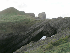
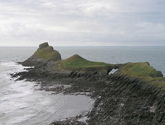
Devil's Bridge is the sea-arch on Middle Head, on the Worm's Head peninsula at the western extremity of the Gower Peninsula, south Wales. The rocky summit just above the arch is the spectacular Outer Head.
There are four distinct 'lumps' to Worm's Head - the long Inner Head, nearest Rhosili; Outer Head, the most distant seen here, and the lower Middle Head consisting of two separate summits, with the arch of Devil's Bridge between them.
Outer Head and Middle Head - Worm's Head peninsula
| |
|
|
The Worm's Head peninsula lies at the western extremity of the Gower Peninsula, south Wales. It is connected to the main part of the Gower at Rhosili by a rocky causeway which is normally only uncovered two-and-a-half hours either side of low tide.
There are four distinct 'lumps' to Worm's Head - the long Inner Head, nearest Rhosili; the spectacular Outer Head, the most distant seen here, and the lower Middle Head consisting of two separate summits, with the arch of Devil's Bridge between them. This view is from the top of Inner Head.
'Blue Lagoon' Abereiddi, Pembrokeshire
| |
|
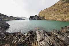
The 'Blue Lagoon' is the flooded lower section of an abandoned 'slate' quarry at Abereiddi bay, Pembrokeshire.
The rock is not true slate (a metamorphic rock) but thinly bedded black shales (Caerhys Shale) which span the Llanvirnian-Llandeilian junction in the Ordovician. On the right of the photo the quarry wall exposes the volcanic Abereiddi Tuff Member.
Abandoned 'slate' quarry, Abereiddi Bay, Pembrokes…
| |
|
Originally uploaded for the GuesswhereUK group. Photo has been replaced with slightly more extensive, uncropped version.
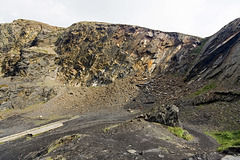
This is the back-wall of the abandoned 'slate' quarry, the flooded section of which is now the Blue Lagoon at Abereiddi bay, Pembrokeshire.
The rock is not true slate (a metamorphic rock) but thinly bedded black shales (Caerhys Shale) which span the Llanvirnian-Llandeilian junction in the Ordovician. Certain bedding planes towards the right-hand side are particularly rich in the graptolite zone fossil Didymograptus murchisoni .
Thousands of people each year see this, either walking past it or attending diving or coasteering (horrible word!) events in the Blue Lagoon.
Pwlldawnau and Penbwchdy, Pembrokeshire
| |
|
|
The little inlet of Pwlldawnau and the headland Penbwchdy, viewed from adjacent to the Pembrokeshire Coastal Path at National grid ref. SM 8808 3692 (a nice place for a sandwich).
The prominent pale rock horizon consists of sandstone and conglomerate at the base of the Ordovician age Ogof Hen Formation. This rests unconformably on the underlying shales of the Cambrian age Lingula Flags. The far headland of Penbwchdy is comprised of a microtonalite sill, an igneous intrusion. If you zoom in on the photo you can see near-vertical columnar cooling joints in the sill.
Traeth Llyfn, Pembrokeshire
| |
|
Traeth Llyfn is an attractive west-facing sandy beach on the north Pembrokeshire coast, viewed here looking north from the coastal path. The cliffs are mostly in the dark grey Aber Mawr Shale Formation (Ordovician), steeply dipping to vertically bedded, with a few thin tuff bands (volcanic ash bands). There are igneous intrusions at the north end of Traeth Llyfn: (a) a dolerite/gabbro sill which forms the un-named northern headland to the bay and (b) a thin dolerite sill just a bit to the south which is visible in the photo forming the white-weathering rib just left of centre.
Access to Traeth Llyfn is by boat or by a bracing walk along the cliff top path from Abereiddi Bay 3/4 of a mile away. There are no facilities here and no vehicular access. So it is very unspoiled.
Lichen at Traeth Llyfn in the late afternoon sun
| |
|
Traeth Llyfn is an attractive west-facing sandy beach on the north Pembrokeshire coast, viewed here looking south-east from the north headland in the late afternoon sun when just about everyone else had gone in for tea.
The cliffs are mostly in the dark grey Aber Mawr Shale Formation (Ordovician), steeply dipping to vertically bedded, with a few thin tuff bands (volcanic ash bands). There are igneous intrusions at the north end of Traeth Llyfn including a dolerite/gabbro sill which forms the un-named north headland to the bay (here).
Access to Traeth Llyfn is by boat or by a bracing walk along the cliff top path from Abereiddi Bay 3/4 of a mile away. There are no facilities here and no vehicular access. A lovely place...
Traeth Llyfn rock ridges, Pembrokeshire
| |
|
Traeth Llyfn is an attractive west-facing sandy beach on the north Pembrokeshire coast. The cliffs are mostly in the dark grey Aber Mawr Shale Formation (Ordovician), steeply dipping to vertically bedded, with a few thin tuff bands (volcanic ash bands). There are igneous intrusions at the north end of Traeth Llyfn: (a) a dolerite/gabbro sill which forms the un-named northern headland to the bay and (b) a thin dolerite sill just a bit to the south which is visible in the photo forming the greeny-buff rib and some of the rounded boulders in the immediate foreground.
Access to Traeth Llyfn is by boat or by a bracing walk along the cliff top path from Abereiddi Bay 3/4 of a mile away. There are no facilities here and no vehicular access. So it is very unspoiled.
Laxford Bay, Sutherland
| |
|
Laxford Bay is the south-eastern extremity of Loch Laxford, a sea loch cut through the Lewisian Gneiss 'knock and lochan' landscape of Sutherland in NW Scotland. A remote, peaceful place.
Achmelvich Bay north inlet, Sutherland
| |
|
|
|
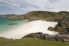
Just perfect white sandy beaches here. Completely unspoiled.
The rock in this locality is Lewisian Gneiss which has been more than usually deformed in the Cansip Shear Zone, a band of sheared and deformed gneiss which extends several miles ESE inland.
Porth Maenmelyn, Pembrokeshire, Wales
| |
|
|
|
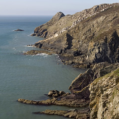
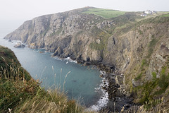
A lovely gem of a bay, virtually inaccessible except by boat or a hazardous, life-threatening scramble down the loose shaly cliffs.
Taken from the Pembrokeshire Coast Path in slightly misty conditions.
On the north (far) side of the bay, the dark shale cliffs change in character to the pale, knobbly, rounded masses of lavas and tuffs belonging to the Porth Maenmelyn and Strumble Head Volcanic Formations (Ordovician).
The dark cleft in the shaly part of the cliff visible to the right of, and slightly above, the centre of the photo (see note), forms the upper part of the old footpath access to the beach, now much degraded and in a dangerous state.
Jump to top
RSS feed- Latest items - Subscribe to the latest items added to this album
- ipernity © 2007-2024
- Help & Contact
|
Club news
|
About ipernity
|
History |
ipernity Club & Prices |
Guide of good conduct
Donate | Group guidelines | Privacy policy | Terms of use | Statutes | In memoria -
Facebook
Twitter

