Earthwatcher's photos
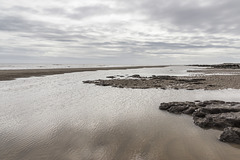
Spurn Neck view south
| |
|
A visit to Spurn Point 6
Looking southwards from Spurn Neck at low tide. Sand and clayey gravel bars parallel to the coast allow the formation of elongate tidal pools, which become completely flooded by the incoming tide.
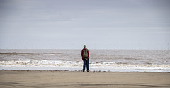
Spurn Neck; looking out to sea
| |
|
A visit to Spurn Point 5
Looking out to sea from Spurn Neck at low tide. The Humber Gateway Offshore Wind Farm is visible in the distance.
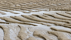
Spurn Neck sand ripples 2
| |
|
|
A visit to Spurn Point 4
Spurn Neck eastern low tide zone.
Asymmetric ripples in beach sand, presumably formed by the previous flood tide(s). The steeper, lee, side of the ripples face west (left); the gentle, stoss, sides face east (right). This indicates that these ripples were formed by water flow moving from right to left, i.e. by the incoming tide. They have clearly survived the previous ebbing tide, suggesting that the incoming tide flows faster than the ebb.
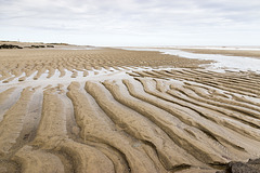
Spurn Neck sand ripples 1
| |
|
|
|
A visit to Spurn Point 3
Spurn Neck eastern low tide zone.
Asymmetric ripples in beach sand, presumably formed by the previous flood tide(s). The steeper, lee, side of the ripples face west (left); the gentle, stoss, sides face east (right). This indicates that these ripples were formed by water flow moving from right to left, i.e. by the incoming tide. They have clearly survived the previous ebbing tide, suggesting that the incoming tide flows faster than the ebb.
Spurn Neck close-up of peaty layer
| |
|
A visit to Spurn Point 2
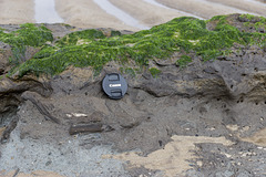
Spurn Neck eastern low tide zone. A close-up view of the pale grey 'Basement Till', a lodgement till ('boulder clay') deposited by ice in the Wolstonian glaciation, 250,000 - 150,000 years ago. This is overlain by the chocolate-brown, rather peaty clay and silt, visible in the centre of the photo. This deposit, with its embeded woody plant remains represents the Ipswichian warm interglacial stage which lasted until 110,000 years ago. This in turn is overlain by the Skipsea Till, (not seen here) deposited by the last glaciation event, which finally ended in this area about 11,500 years ago.
The lens cap is 72 mm in diameter.
Spurn Neck Basement Till and peaty layer
| |
|
|
A visit to Spurn Point 1
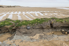
Low tide at Spurn Neck exposes the pale grey 'Basement Till', a lodgement till ('boulder clay') deposited by ice in the Wolstonian glaciation, 250,000 - 150,000 years ago. This is overlain by the chocolate-brown, rather peaty clay and silt, visible in the centre of the photo. This deposit, with its embeded woody plant remains represents the Ipswichian warm interglacial stage which lasted until 110,000 years ago. This in turn is overlain by the Skipsea Till, which comprises the low cliffs seen in the far distance, deposited by the last glaciation event, which finally ended in this area about 11,500 years ago.
The lens cap is 72 mm in diameter.
Rough Standhills early autumn pine avenue
| |
|
|
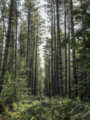
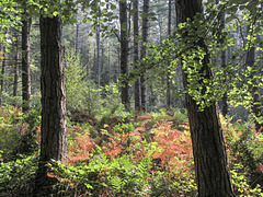
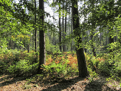
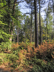
Looking along an avenue of pines in early autumn in Rough Standhills.
Rough Standhills is a largely coniferous plantation, mostly Sitka spruce, on the south side of the Limb Valley in south west Sheffield. There are occasional open clearings and rides in the otherwise densely planted trees, where bracken, bramble, and broad-leaved trees such as beech, birch and oak have taken hold.
Early autumn colours in Rough Standhills 4
| |
|
|
|
Early autumn colours in a fully zoomed-in view over a clearing in Rough Standhills, to the dense coniferous woodland beyond.
Rough Standhills is a largely coniferous plantation, mostly Sitka spruce, on the south side of the Limb Valley in south west Sheffield. There are occasional open clearings and rides in the otherwise densely planted trees, where bracken, bramble, and broad-leaved trees such as beech, birch and oak have taken hold.
Early autumn colours in Rough Standhills 3
| |
|
|
|
Early autumn colours in a zoomed-in view over a clearing in Rough Standhills, to the dense coniferous woodland beyond.
Rough Standhills is a largely coniferous plantation, mostly Sitka spruce, on the south side of the Limb Valley in south west Sheffield. There are occasional open clearings and rides in the otherwise densely planted trees, where bracken, bramble, and broad-leaved trees such as beech, birch and oak have taken hold.
Early autumn colours in Rough Standhills 2
| |
|
|
|
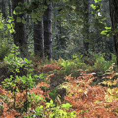
Early autumn colours in a clearing in Rough Standhills.
Rough Standhills is a largely coniferous plantation, mostly Sitka spruce, on the south side of the Limb Valley in south west Sheffield. There are occasional open clearings and rides in the otherwise densely planted trees, where bracken, bramble, and broad-leaved trees such as beech, birch and oak have taken hold.
Early autumn colours in Rough Standhills 1
| |
|
|
Early autumn colours in Rough Standhills - a largely coniferous plantation on the south side of the Limb Valley in south west Sheffield. Rough Standhills is a largely coniferous plantation, mostly Sitka spruce, on the south side of the Limb Valley in south west Sheffield.
There are occasional open clearings and rides in the otherwise densely planted trees, where bracken, bramble, and broad-leaved trees such as beech, birch and oak have taken hold.
Handfasting Ground devastation 2
| |
|
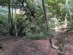
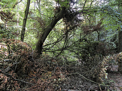
A recent fallen tree has brought chaos to the 'bowing beech' where we held our handfasting ceremony at the Summer Solstice in 2005.
It's a bit sad, but the woodland is constantly changing anyway; nothing stays the same for ever.
In April 2005 it looked like this...
... and at the Winter Solstice in 2009 it looked like this:
Handfasting Ground devastation 1
| |
|
A recent fallen tree has brought chaos to the 'bowing beech' where we held our handfasting ceremony at the Summer Solstice in 2005.
It's a bit sad, but the woodland is constantly changing anyway; nothing stays the same for ever.
In April 2005 it looked like this:
Beech in the spotlight
| |
|
|
|
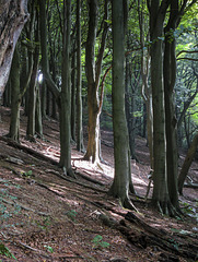
A patch of sunlight illuminates a beech tree in Bole Hill Plantation, in the Limb Valley on the west side of Sheffield.
Looking to Fulwood Hall
| |
|
|
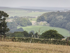
Fulwood Hall in the centre of the photo, viewed from the northern edge of the Limb Valley Bole Hill Plantation on a bright but hazy morning. The high rounded summit on the distant skyline is Margery Hill, 546 m, SK 189 957, about 10 miles to the north-west, in the Dark Peak.
Wigley Farm fields view to Castle Dyke Lodge 3
| |
|
|
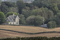
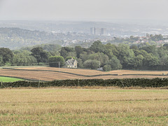
A fully zoomed-in view over the fields of Wigley Farm on the west side of Sheffield.
The prominent house is Castle Dyke Lodge, formerly Hoyle House on old Ordnance Survey maps. Just in front of the house, in the newly harvested and harrowed fields is a small, dry valley, possibly initiated as a melt-water stream at the end of the Devensian glacial period, but no longer having any flowing water, except as a smaller feeder to a pond in the grounds of Castle Dyke house, hidden in the trees.
Wigley Farm fields view to Castle Dyke Lodge 2
| |
|
|
A closer, zoomed-in view over the fields of Wigley Farm on the west side of Sheffield. I liked the soft light in the middle distance on this bright but hazy morning. The city centre is visible through the haze on the right of the photo. The two tall buildings in the centre are the university Arts Tower and the Hallamshire Hospital.
The prominent house just left of centre is Castle Dyke Lodge, formerly Hoyle House on old Ordnance Survey maps. Just in front of the house, in the newly harvested and harrowed fields is a small, dry valley, possibly initiated as a melt-water stream at the end of the Devensian glacial period, but no longer having any flowing water, except as a smaller feeder to a pond in the grounds of Castle Dyke house, hidden in the trees.
Wigley Farm fields view to Castle Dyke Lodge 1
| |
|
|
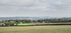
A view over the fields of Wigley Farm (extreme left) on the west side of Sheffield. I liked the soft light in the middle distance on this bright but hazy morning. The city centre is visible through the haze on the right of the photo.
The prominent house just right of centre is Castle Dyke Lodge, formerly Hoyle House on old Ordnance Survey maps. Just in front of the house, in the newly harvested and harrowed fields is a small, dry valley, possibly initiated as a melt-water stream at the end of the Devensian glacial period, but no longer having any flowing water, except as a smaller feeder to a pond in the grounds of Castle Dyke house, hidden in the trees.

