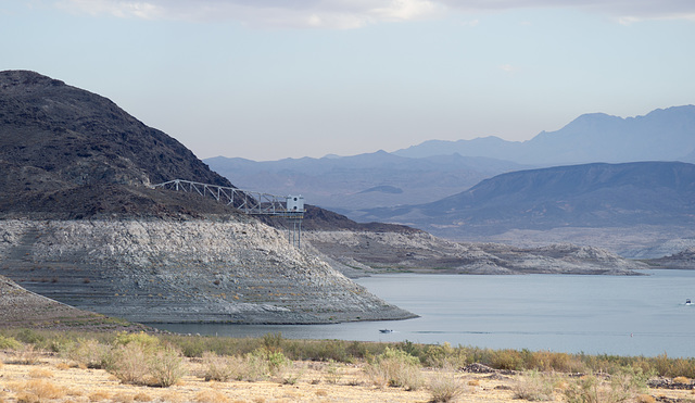
Lake Mead NV perspective (#0117)
Lake Mead NV CO2 boating (#0118)
Lake Mead NV lake evaporator (#0119)
Lake Mead NV fishermen (#0121)
Lake Mead NV (#0122)
Palm Springs Parade of Planes (#0003)
Palm Springs Parade of Planes (#0009)
Palm Springs Parade of Planes (#0010)
Palm Springs Parade of Planes (#0015)
Palm Springs Parade of Planes (#0018)
Palm Springs Parade of Planes Ercoupe (#0020)
Palm Springs Parade of Planes Ercoupe (#0021)
Palm Springs Parade of Planes Aermacchi MB-326 Imp…
Palm Springs Parade of Planes Aermacchi MB-326 Imp…
Palm Springs Parade of Planes Aermacchi MB-326 Imp…
Palm Springs Parade of Planes (#0028)
Palm Springs Parade of Planes CUBCRAFTERS (#0029)
Palm Springs Parade of Planes (#0033)
Palm Springs Parade of Planes (#0034)
Palm Springs Parade of Planes (#0036)
Palm Springs Parade of Planes Quest Kodiak 100 (#0…
Palm Springs Parade of Planes Eclipse 500 (#0048)
Palm Springs Parade of Planes (#0049)
Lake Mead NV Marina (#0112)
Lake Mead NV (#0109)
Lake Mead NV sunrise (#0108)
Beaver UT Carnegie library (#0105)
Beaver UT New Deal (#0103)
Emery, UT (#102)
Emery, UT (#101)
Castle Dale UT power plant (#0100)
Helper UT (#0093)
Helper UT (#0092)
Helper UT D&RGW spreader (#0091)
Helper UT Civic Auditorium Big John (#0088)
Helper UT Civic Auditorium (#0089)
Helper UT Civic Auditorium (#0087)
Helper UT Civic Auditorium (#0086)
Helper UT Civic Auditorium (#0085)
Helper UT (#0083)
Helper UT Amtrak (#0081)
Helper UT (#0080)
Helper UT Strand Theater (#0079)
Helper UT (#0078)
Helper UT (#0077)
Location
See also...
Keywords
Authorizations, license
-
Visible by: Everyone -
Attribution + non Commercial + no derivative
-
324 visits
Lake Mead NV speedboat (#0116)


Speedboat passing some part of the Las Vegas water system. I've never seen a description of what this is, but if you look at the satellite photos you'll see that it's linked to some to either the water (or sewer) system in some way.
- Keyboard shortcuts:
Jump to top
RSS feed- Latest comments - Subscribe to the comment feeds of this photo
- ipernity © 2007-2024
- Help & Contact
|
Club news
|
About ipernity
|
History |
ipernity Club & Prices |
Guide of good conduct
Donate | Group guidelines | Privacy policy | Terms of use | Statutes | In memoria -
Facebook
Twitter

www.landwellco.com/index.php/past/historical-timeline
Don Barrett (aka DBs… club has replied to Clintdigitalcollections.mypubliclibrary.com/c/Henderson-Memories/view/17194/Aerial+view+of+Henderson%2C+Nevada/?q=Basic+Magnesium%2C+Inc.&fieldLimit=3-166&fq[]=q&fq[]=10%3APhotographs
slgwv club has replied to ClintDon Barrett (aka DBs… club has replied to slgwv clubslgwv club has replied to Don Barrett (aka DBs… clubDon Barrett (aka DBs… club has replied to slgwv clubwww.cbsnews.com/news/las-vegas-uncaps-lake-meads-third-straw-for-water-supply
Back In The Day a good buddy of mine who had a boat on Lake Mead (well, truth to tell, it was his mom's boat) thought it was great fun to drive unsuspecting passengers under that water intake. It leaked enough that they'd get seriously splashed! Of course, that's not possible now--
The intake is built on the side of Saddle Island, which is an island only at the very highest water levels. It's actually an outcrop of Precambrian crystalline rock, unlike the much younger volcanics in the mountains around.
Sign-in to write a comment.