
Baden, Frau & Landschaft / Woman & landscape
Die Wolke
Elcito ~ ~ ~ dem Himmel sehr nah ~ ~ ~
Morning and afternoon HFF from my place of birth
Baden, Doblhoffteich / Doblhoff Pond
Baden, Urlaub am Strand / Holidays on the beach
Baden, Orangerie & Rosarium / Orangery & Rosarium
Ruderi del Castello di Gusaliggio - Val Mozzola
Sonnenaufgang im Seetal / Sunrise at Lake Valley
Pian Grande mit den weißen Rindern
Pian Grande
Heimfahrt
Morgenstimmung
Spätsommermorgen / Late summer morning
Abendstimmung
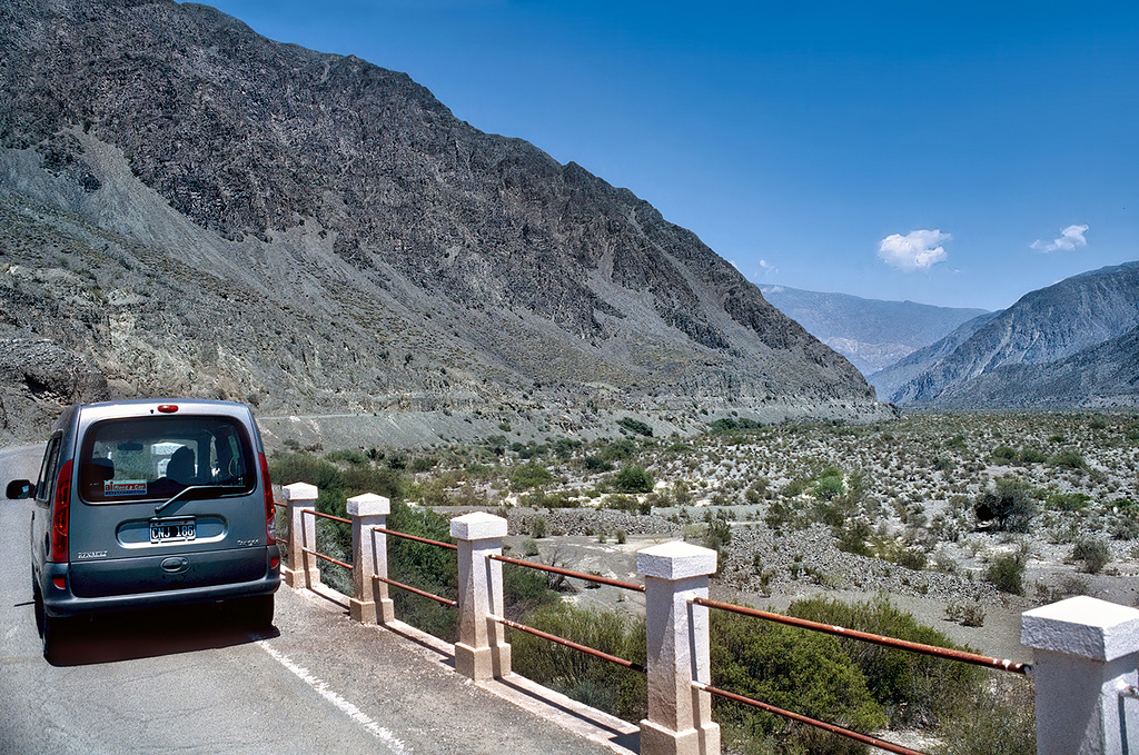
Ruta 12 - little Kangoo's adventures
Ebbe
Fangtag
Taubenschaukel am Tiber (2 x PiP)
HFF - Matera - City of Stones
Gewaltig
H.A.N.W.E - in the Alps
Mittagspause
Rio San Juan - Ruta 12
Ischigualasto - El Hongo
H.H.F. - in Montafon (with PiP)
Ischigualasto - desert
Ischigualasto - El Submarino
Heide bij Exloo
Kaisergebirge
Relaxe the moment
Voisthalerhütte, Alt & neu / Old & new
Ischigualasto - entering valley of the moon
The lonely hiker
Plaun Segnas Sut · (PiP)
hiking along the valley
Talampaya Gorge
falling fog
Wilder Kaiser
Ruta 40 - Cuesta de Miranda
Burg Falkenstein
Burg Falkenstein
Mina Concordia - 4144 m
Wien, Volksgarten / Vienna, People's Garden
Rose im Nebel
Location
See also...
Keywords
Authorizations, license
-
Visible by: Everyone -
All rights reserved
-
234 visits
Ruta 12 - Rio San Juan


This image of the valley shows what's now the upstream part of the large reservoir "Punta Negra", used for power generation and irrigation purposes. The PiP shows a section, which is situated a little bit more downstream. The region was very lonesome back then. Now the old road is mostly under water, its course can still be seen on Google Earth. - scanned slide, Minolta X700
Andy Rodker, ColRam, Leo W, Erhard Bernstein and 24 other people have particularly liked this photo
- Keyboard shortcuts:
Jump to top
RSS feed- Latest comments - Subscribe to the comment feeds of this photo
- ipernity © 2007-2024
- Help & Contact
|
Club news
|
About ipernity
|
History |
ipernity Club & Prices |
Guide of good conduct
Donate | Group guidelines | Privacy policy | Terms of use | Statutes | In memoria -
Facebook
Twitter
Berny club has replied to tiabunna clubSign-in to write a comment.