Monochrome
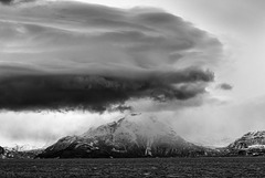
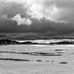
Bad weather on the way
| |
|
|
|
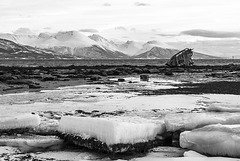
Shipwreck
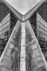
Tromsø Bibliotek
| |
|
|
|
Tromsø City library and archive was opened in 2005. The characteristic roof of the former Fokus cinema designed in the style of architect Félix Candela was retained.
Die Stadtbücherei/ Stadtarchiv von Tromsø wurden 2005 eröffnet. Das charakteristische Dach des früheren Fokus- Kinos im Stil des Architekten Félix Candela wurde dabei beibehalten.
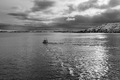
Gone fishing
| |
|
|
|
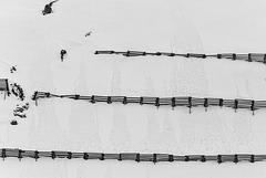
Lawinenverbauung
| |
|
|
|
In the current heat an unseasonal fence may give some relief;-)
HFF everybody!
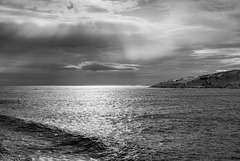
Silver Sea
| |
|
|
|
Desolation of Mordor
| |
|
|
|
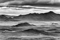
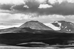
Möðrudalsöræfi seen from the viewpoint on Road 901/ Möðrudalsleið. A barren wilderness of cones and ridges from subglacial fissure eruptions during the last ice age.
A panorama of the whole vista in colour:
www.ipernity.com/doc/523247/35794459
Highland desert
| |
|
|
|
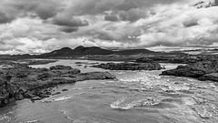
River Kreppá in the Icelandic highlands, a desert of lava and pumice created by various volcanic eruptions, most notably from Askja. www.vatnajokulsthjodgardur.is/en/areas/odadahraun/interpretation-and-knowledge/about-askja
Road F910 (4x4 only) crosses the river on one of the very few bridges in the area. Note how high the bridge is, fording would often be impossible.
www.vatnajokulsthjodgardur.is/en/areas/odadahraun
I'm off to Iceland again, see you in August!
Askja
| |
|
|
|
Inside Askja Caldera, still covered with snow in mid July. Askja /DyngjufjöllI is a central volcano in the Icelandic highlands and part of Vatnajökull National Park. futurevolc.vedur.is/?volcano=ASK
In der Askja-Caldera, die Mitte Juli noch immer mit Schnee bedeckt war. Askja/ Dyngjufjöll ist ein Zentralvulkan im isländischen Hochland und Teil des Vatnajökull Nationalparks. de.wikipedia.org/wiki/Askja
Grafarlandaá
| |
|
|
|
Ford through Grafarlandaá on Highland road F88 (Öskjuleið). See inset photo for driving instructions;-)
Grafarlandaà is a spring fed river so it's not as unpredictable as glacial rivers where fords can get impassible on sunny days due to increased melt.
Furt durch den Fluss Grafarlandaá auf der F88 (Öskjuleið). Grafarlandaá entspringt aus Quellen in der Lava und ist deshalb weniger unberechenbar als Gletscherflüsse, wo im Laufe von sonnigen Tagen die Furten oft unpassierbar werden. Das PiP zeigt Instruktionen zum korrekten Queren des Flusses inklusive Notfallnummer;-)
Trölladyngja
| |
|
|
|
Trölladyngja (1468m) is Iceland's largest shield volcano with a 10km diameter and a 100m deep oblong crater. It lies in the wasteland north of Vatnajökull and is part of the National Park.
Trölladyngja (1468m) ist Islands größter Schildvulkan. Er hat einen Durchmesser von 10km und einen 100m tiefen ovalen Krater. Er liegt in der Vulkanwüste nördlich des Vatnajökull und ist Teil des gleichnamigen Nationalparks.
Bárðarbunga
| |
|
|
|
Bárðarbunga is a 2009m high central volcano under Vatnajökull with a 65km² large ice filled caldera and a 190 km long and up to 25 km wide fissure swarm. The most recent eruption was the 2014/15 Holuhraun fissure eruption, the largest in Iceland since Laki. Excellent detailed info: futurevolc.vedur.is/?volcano=BAR
This photo was taken from Highland road F26, Sprengisandur, about 6 weeks before the start of Holuhraun. See inset photos for the state of the road after a long winter.
Infos about the caldera collapse: en.vedur.is/about-imo/news/on-the-bardarbunga-gradual-caldera-collapse
Bárðarbunga ist ein 2009m hoher Zentralvulkan unter Vatnajökull. Er hat eine 65km² große eisgefüllte Caldera, das gesamte Vulkansystem erstreckt sich über 190km Länge und bis zu 25 km Breite. Bárðarbunga liegt über dem isländischen Hotspot und auf der Bruchzone. Die letzte Eruption 2014/15 im Holuhraun war die größte in Island seit Laki und förderte 1,6km³ Basaltlava.
Das Foto zeigt den Vulkan 6 Wochen vor Holuhraun von der Hochlandpiste Sprengisandur (F26) im Westen. Die Piste war noch nicht lange geöffnet und war noch sehr nass
Fjörðungsalda and Tungnafellsjökull
| |
|
|
|
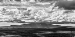
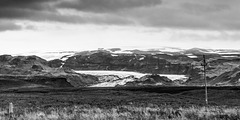
Fjörðungsalda (the low hill with the mast) lies in the middle of the Icelandic highlands and demarcates the watershed between North and South. The taller hill in the background is Tungnafellsjökull, a 1523m high glaciated volcano west of Vatnajökull. icelandicvolcanos.is/?volcano=TUN
Fjörðungsalda (der niedrige Berg mit dem Mast) liegt in der Mitte des isländischen Hochlands und ist die Wasserscheide zwischen Nord und Süd. Der Berg im HIntergrund ist Tungnafellsjökull, ein 1523m hoher vergletscherter Vulkan westlich vom Vatnajökull.
I am back online but have a lot of catching up to do, so I probably won't be able to visit and comment all of your photos.
Ich bin wieder da und sehr im Rückstand, deswegen werde ich wohl in nächster Zeit nicht alle eure Fotos besuchen und kommentieren können.
Dark clouds over Katla
| |
|
|
|
Mýrdalsjökull and outlet glacier Sólheimajökull seen from the ring road. Because of an unusually high level of seismic unrest in Katla caldera the aviation colour code was raised to yellow and civil protection declared a state of uncertainty. For the moment the activity has gone down again but the volcano continues to be monitored closely.
futurevolc.vedur.is/?volcano=KAT
Mýrdalsjökull und Auslassgletscher Sólheimajökull von der Ringstrasse. Wegen eines ungewöhnlich starken seismischen Schwarms wurde die Warnstufe für den Flugverkehr auf Gelb gesetzt und der Katastrophenschutz hat einen Status erhöhter Wachsamkeit ausgerufen. Momentan ist die Aktivität wieder zurückgegangen, aber der Vulkan wird weiterhin engmaschig überwacht.
de.wikipedia.org/wiki/Katla
Skeiðarársandur (PiP)
| |
|
|
|
Ring road through Skeiðarársandur, the largest outwash plain in Iceland. See inset photos, the second one is clickable.
Deutsch: de.wikipedia.org/wiki/Skei%C3%B0ar%C3%A1rsandur
Öræfajökull - a volcano awakening (PiP)
| |
|
|
|
Öræfajökull is part of Vatnajökull and a subglacial volcano. Hvannadalshnúkur (2110m), Icelands highest peak, is on its caldera rim.
Öræfajökull has recently had intrusions from depth (20-30km) and a few days ago was found to have developed a hydrothermal cauldron and sulphur smells from one of its outlet glaciers (Kviárjökull, see note). This has led to a state of uncertainty being declared.
An uncomfortable fact: "A flood from Öræfajökull could reach a human area in a shorter period than it takes to clear the area. Civil protection has prioritized the creation of a new evacuation plan. About two thousand people go around the area every day during the winter season. That number multiplies in the summer."
Scientists think it will take quite a while (Eyafjallajökull took 14 years) until the volcano will erupt but it has started gearing up towards an eruption. If it erupts it can get really nasty with enormous jökulhlaups and pyroclastic flows, as the historic eruptions show.
theconversation.com/is-icelands-tallest-volcano-awakening-87132
www.vedur.is/gogn/vefgogn/jokulhlaup/haettumat/oraefajokull_markarfljotsaurar/bok_en/chapter_I.pdf
Öræfajökull ist Teil des Vatnajökull und bezeichnet auch den subglazialen Vulkan darunter. Islands höchster Berg, Hvannadalshnúkur (2110m), ist am Rand der Caldera.
Öræfajökull zeigt seit dem Sommer Zeichen der Unruhe, Magma ist aus 20-30 km Tiefe aufgestiegen und am Freitag wurden eine große Vertiefung im Eis und Schwefelgestank an einem Auslassgletscher (Kviárjökull, siehe PiP) entdeckt. Deshalb wurde Alarmstufe gelb (Status der Ungewissheit) ausgerufen.
Eine ungemütliche Tatsache: "Ein Gletscherlauf vom Öræfajökull kann bewohnte Gebiete schneller erreichen als diese evakuiert werden können. Der Katastrophenschutz priorisiert deshalb das Aufstellen eines neuen Evakuierungsplans. Im Winter sind täglich etwa 2000 Personen in dem Gebiet, im Sommer sehr viel mehr."
Wissenschaftler gehen davon aus, dass es Jahre dauern kann, bis der Vulkan tatsächlich ausbricht (Eyafjallajökull brauchte 14 Jahre). Wenn, dann kann es eventuell sehr häßlich werden mit pyroklastischen Strömen, großen Gletscherläufen und sehr viel Asche, wie die dokumentierten früheren Eruptionen zeigen.
de.wikipedia.org/wiki/%C3%96r%C3%A6faj%C3%B6kull
Stitched from 2 photos
EXIF: 1/160 • f/9.0 • 109.0 mm • ISO 100/ Canon EOS 6D/ EF70-200mm f/4L USM
Kjalvegur
| |
|
|
|
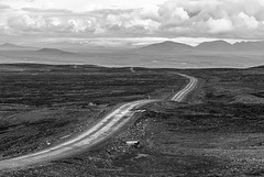
Highland route 35 (Kjalvegur) traverses the highlands from north to south, starting near Blönduós and leading over the Kjölur plateau between Langjökull and Hofsjökull glaciers to Gullfoss. Since all rivers have been bridged, the 168 km long mountain road can now also be used by normal cars though it is like washboard in many places.
This photo was taken near the pass at Bláfell looking south.
Kirkjan
| |
|
|
|
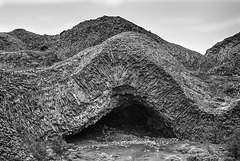
Kirkjan (Church) is part of Hljóðaklettar (Echo Rocks) in the gorge of Jökulsá á Fjöllum river. Hljóðaklettar belong to an old crater row which has been heavily eroded by jökulhlaups so that only the plugs are left. They display columnar basalt in a fascinating wealth of shapes.
Kirkjan (Kirche) ist Teil der Hljóðaklettar (Echofelsen) in der Schlucht des Flusses Jökulsá á Fjöllum. Die Hljóðaklettar sind Teil einer alten Kraterreihe und wurden durch Gletscherläufe stark erodiert, sodass nur noch die Schlote stehenblieben. Der Säulenbasalt zeigt einen Formenreichtum, der selbst in Island selten ist.
Here you can just about see two people for size reference!
Basalt roof inside the cave
Jump to top
RSS feed- Latest items - Subscribe to the latest items added to this album
- ipernity © 2007-2024
- Help & Contact
|
Club news
|
About ipernity
|
History |
ipernity Club & Prices |
Guide of good conduct
Donate | Group guidelines | Privacy policy | Terms of use | Statutes | In memoria -
Facebook
Twitter

