Bolivia
Folder: Latin America
Road to Tupiza (PiP)
| |
|
|
|
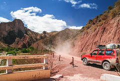
Viewpoint over Rio Tupiza on RN 14 (1st inset). A bit further on they were working on widening the road- the diversion was through the river bed (see insets). Nowadays the days of gravel are gone- RN 14 is asphalted all the way to the border at Villazón/ La Quiaca.
HFF everybody!
I'm off to Braunschweig www.ipernity.com/group/2220924 , will be back commenting next week.
Quebrada de Palala (PiP)
| |
|
|
|
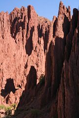
Tupiza (2850m) in SW Bolivia has a pleasant climate and is surrounded by dramatic canyons with eroded red rock pillars. Quebrada de Palala is one of them, it's usually dry except in the rainy season when it carries a tributary to Tupiza river.
Tupiza (2850m) in SW Bolivien hat ein angenehmes Klima und ist von dramatischen Canyons mit erodierten roten Felsnadeln umgeben. Die Quebrada de Palala ist einer davon, der die meiste Zeit trocken ist, aber in der Regenzeit einen Nebenfluss zum Rio Tupiza führt.
Tupiza-San Vicente Road (PiP)
| |
|
|
|
The unsurfaced toll road connecting Tupiza (2965m) and the mining town of San Vicente (4498m) is used by lorries - compared to other roads in the area it is in very good condition! The first inset shows the continuation of the road up to ca. 4000m at Cerro Huaynacancha, the photos were taken at appr. 3700m.
Die Schotterstrasse zwischen Tupiza (2965m) und der Bergwerksstadt San Vicente (4498m) kostet Gebühr und ist für dortige Verhältnisse sehr gut ausgebaut, da sie von Lastwagen befahren wird. Das erste PiP zeigt den Strassenverlauf hinauf auf ca. 4000m beim Cerro Huaynacancha, die Fotos wurden auf ca. 3700m Höhe gemacht.
Oreocereus trollii
| |
|
|
|
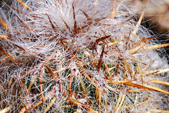
Oreocereus trollii is a cactus growing in Northern Argentina and Bolivia at altitudes of 3000-4000m. It can grow up to 50cm tall, is covered in (hard) white "wool" and has very sharp yellowish thorns.
This photo was taken on the Tupiza-San Vicente road at El Sillar at appr. 3700m.
El Sillar (PiP)
| |
|
|
|
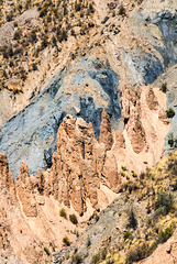
The area around Tupiza has spectacular quebradas and erosion landscapes (also see inset photo)
Refuelling
| |
|
|
|
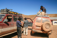
In thinly populated SW Bolivia filling stations are very rare. Cars need to carry their petrol on the roof, refuelling is done as seen in the photo. After 3 days of bumpy tracks one of the canisters started leaking and needed to be emptied.
Butch Cassidy's last resting place (PiP)
| |
|
|
|
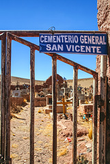
Supposedly Butch Cassidy and Sundance Kid were shot and buried in San Vicente, a zinc and silver mining town situated at 4498m in SW Bolivia.
content.time.com/time/world/article/0,8599,1951085,00.html
Deutsch: de.wikipedia.org/wiki/San_Vicente_(Potos%C3%AD)
HFF everybody!
X-legged beauties
| |
|
|
|
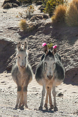
A very pregnant donkey and her one year old foal on the roadside in the Bolivian Altiplano.
San Antonio del Nuevo Mundo (3xPIP)
| |
|
|
|
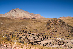
San Antonio del Nuevo Mundo was a mining town which at its peak in the 17th century had about 150.000 inhabitants. It is said that even in precolumbian times the Inca mined there for silver. When water repeatedly flooded the mine shafts the town and mines were given up. Though an enormous amount of silver is said to remain in the mountain the altitude and remote location make mining uneconomical.
The mountain in the background is the lower (>5900m) of the twin peaks of Cerro Lípez, a 5929 m high stratovolcano.
In the notes the ruins of the old and "new" church and an altitude sign.
San Antonio del Nuevo Mundo war eine Bergwerksstadt, die zu ihren besten Zeiten im 17. Jh ca. 150.000 EInwohner hatte. Vermutlich wurde dort schon in vorkolumbianischen Zeiten von den Inka SIlber abgebaut.Wegen wiederholter Wassereinbrüche wurden Stadt und Minen aufgegeben, es sollen aber noch gewaltige Mengen an Silber im Berg sein. Wegen der Höhe und sehr abgelegenen Lage ist der Abbau derzeit nicht wirschaftlich.
Der Berg im HIntergrund ist der niedrigere der Doppelgipfel des Vulkans Cerro Lípez (5929m), der aber auch noch mehr als 5900m hoch ist.
In den PiPs die Ruinen der alten und "neuen" Kirche sowie eine Höhenangabe.
Thin air
| |
|
|
|
A nameless pass at 4929m in the remote SW corner of Bolivia
Ein namenloser Pass auf 4929m Höhe im abgelegenen südwestlichen Zipfel Boliviens
Laguna Morijón and Volcán Uturuncu (PiP)
| |
|
|
|
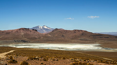
6008m high Uturuncu made it into the news some time ago when scientists published a paper about a yearly uplift of 1-2cm over a 70km radius around the volcano. Subsequently Uturuncu was hyped as a supervolcano bringing doom to mankind.. That's not going to happen any time soon though;-)
www.nytimes.com/2012/02/14/science/a-fascinating-growth-spurt-at-the-uturuncu-volcano-in-bolivia.html
Der 6008m hohe Uturuncu wurde in der Presse vor einiger Zeit als neuer Supervulkan gehypt, aber die Weltuntergangsszenarien werden sicher noch ganz lange Zeit nicht eintreffen, wenn überhaupt je... Hintergrund war eine wissenschaftliche Studie, die feststellte, dass sich in einem 70km-Radius die Erde um 1-2cm pro Jahr hebt.
www.vulkane.net/vulkane/uturuncu/uturuncu.html
www.spiegel.de/wissenschaft/natur/uturuncu-in-den-anden-forscher-entdecken-neuen-supervulkan-a-823405.html
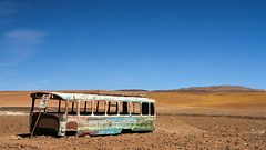
Estacionamento - parked forever!
Salar de Chalviri
| |
|
|
|
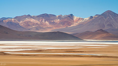
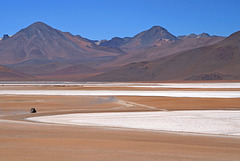
Salar de Chalviri is a salt flat in SW Bolivia at a height of ca. 4400m. It lies in the National Reserve of Andean Fauna Eduardo Avaroa and the whole area is part of the huge Altiplano-Puna Volcanic complex with its large nested calderas and geothermal areas.
volcano.oregonstate.edu/altiplano-puna-volcanic-complex
Der Salar de Chalviri ist eine Salzwüste auf ca. 4400m im südwestlichen Bolivien und Teil des Nationalparks Eduardo Avaroa für andine Fauna. Die ganze Gegend gehört zum riesigen Altiplano-Puna Vulkankomplex (APVC) mit unzähligen Vulkanen, riesigen Calderen und Geysirgebieten. Der APVC wird mit gerne mit Yellowstone verglichen und oft als Supervulkan gehypt.
Salar de Chalviri
| |
|
|
|
Part of Reserva Nacional de Fauna Andina Eduardo Avaroa in SW Bolivia - the "Bolivian Tibet"
Salar de Chalviri
| |
|
|
|
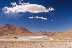
Salt flat with lagoons and hot springs, situated at ca. 4400m in Eduardo Avoaroa National Park in SW Bolivia
en.wikipedia.org/wiki/Eduardo_Avaroa_Andean_Fauna_National_Reserve
Salzpfanne mit Seen und heißen Quellen, auf ca. 4400m Höhe im Eduardo Avaroa Nationalpark im Südwesten Boliviens gelegen.
de.wikipedia.org/wiki/Reserva_Nacional_de_Fauna_Andina_Eduardo_Avaroa
Laguna Salada
| |
|
|
|
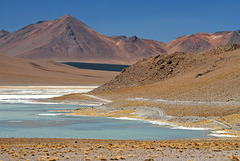
Laguna Salada (ca. 4400m) is part of Salar de Chalviri in Eduardo Avaroa National Park, SW Bolivia
Termas de Polques
| |
|
|
|
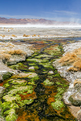
The outflow at the hot springs is covered with colourful heat loving algae, the white stuff is salt. In the background over Salar de Chalviri salt is whirled up by the wind.
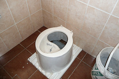
Solo Pipi
| |
|
|
|
Today, 19. November, is "World toilet day", time for a little light relief;-)
They asked 8 Bolivianos (1 €) for the use of this....
The photos were taken at Centro Comunal Quetena Grande which was built with Japanese money and is run by the local indigenous communities. The Centro Comunal is situated at Termas de Polques in Eduardo Avaroa Reserve at a height of appr. 4400 m.
Jump to top
RSS feed- Latest items - Subscribe to the latest items added to this album
- ipernity © 2007-2024
- Help & Contact
|
Club news
|
About ipernity
|
History |
ipernity Club & Prices |
Guide of good conduct
Donate | Group guidelines | Privacy policy | Terms of use | Statutes | In memoria -
Facebook
Twitter

