Upper Yosemite Falls.
On the way to Glacier Point
Approach to Tioga Pass
Ellery Lake
Sierra Pond, Yosemite National Park, 1980 (060°)
Tuolumne Meadows - Yosemite National Park (090°)
Tunnel View (090°)
Clouds Rest and Half Dome from Olmsted Point (210°…
Black and White, Yosemite NP (075°)
Tenaya Lake 1980 (045°)
Glacier Point Vista (090°)
Glacier Point Vista (105°)
Tuolumne Meadows from Pothole Dome - Sept. 1978 (0…
Tenaya Lake from Olmsted Point (045°)
Tenaya Creek - Yosemite NP - Sept. 1989
Tenaya Lake from Olmsted Point 1980 (045°) - initi…
Tenaya Lake from Olmsted Point, Yosemite NP 1980 (…
Thundering Yosemite Falls, May 1980 (000°)
Thundering Yosemite Falls - May 1980
Tenaya Lake, Yosemite N.P. (060°)
White Cascade at Glen Aulin
Looking down the Tuolumne river
Tuolumne River
Elements of Yosemite
Yosemite Granite
May Lake (0217)
at the Lembert Dome
Location
See also...
Keywords
Authorizations, license
-
Visible by: Everyone -
All rights reserved
-
620 visits
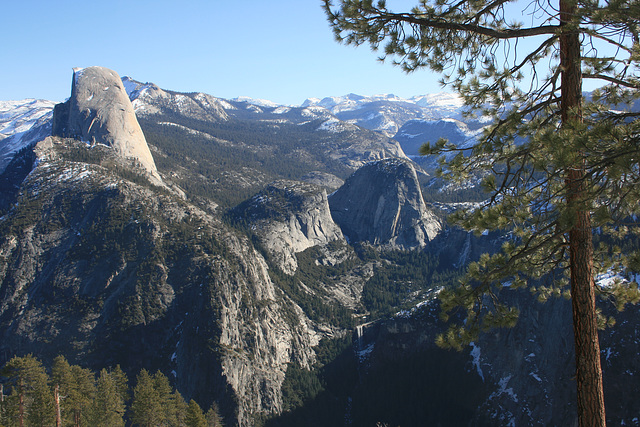
Half Dome and upper Yosemite Valley.


From the Glacier Point road, a ski trail in the winter! This is the valley of the upper Merced River; Nevada Falls and Vernal Falls (both outlined) are visible. The dome just to (our) left of Nevada Falls is Liberty Cap, from its resemblance to caps worn by some Patriots during the American Revolution. Yosemite National Park, California, USA. Map position is approximate due to the loss of the satellite view option!
, , William Sutherland have particularly liked this photo
- Keyboard shortcuts:
Jump to top
RSS feed- Latest comments - Subscribe to the comment feeds of this photo
- ipernity © 2007-2024
- Help & Contact
|
Club news
|
About ipernity
|
History |
ipernity Club & Prices |
Guide of good conduct
Donate | Group guidelines | Privacy policy | Terms of use | Statutes | In memoria -
Facebook
Twitter

Admired in:
www.ipernity.com/group/tolerance
Admired in ~ I ♥ Nature
Sign-in to write a comment.