Der Hafen der Insel Porto Santo im Atlantik
Lincoln-ctr underground
NRP AURIGA im Hafen Funchal auf Madeira
Barcellona : ANTONI GAUDI - dettaglio artistico de…
SPC 10/2019 : 'Emotions'- volare via...è arrivato…
Barcellona : la Sagrada Familia , interior view :…
Barcellona : Sagrada Familia, interior view
Barcellona : La Sagrada Familia frontal
Barcellona : vista laterale della Sagrada Familia…
Barcellona : La Sagrada Familia, frontal view
Am Königspalast in Bankok 1981
Großer Palast (Bangkok) 1981
Barcellona: Le possenti colonne che reggono la Sag…
Barcellona : Ora quattro passi nella Rambla a fare…
Barcellona : Una bella coreografia nella Rambla
Am Palstgraben in Mandaly mit Blick zum Mandaly Hü…
Barcellona : La Rambla, 27 novembre = voglia di '…
Barcellona : La Rambla - un bel penta-lampione
Barcellona : The bicycle rental in Plaça de Catalu…
Sonnenuntergang in Bagan am Irrawady
Sonnenuntergang in Bagan am Irrawady
Alte Kirche St-Hubert in Le Noirmont
Le Noirmont im Jura als Winter-Wunderland
Barcellona : Il grande mercato centrale La Boqueri…
Sicht auf den Pico do Castelo auf Porto Santo, 437…
Hafeneinfahrt Porto Santo
Barcellona : Casa Batlló , vista dal basso davanti…
Der Pfälzerwald mit seinen Burgen und Schlössern
Impsannte Burg Trifels
Barcellona : Una composizione artistica di ANTONI…
Barcellona : Casa Batlló - una composizione artist…
Reichsburg Trifels
Felsturm Asselstein
Barcellona : Casa Batlló , vista posteriore sopra…
Barcellona : Casa Batlló - la vetrata al 5° piano
Blick über das Pfälzer Weinland von der Burg Lande…
Ein zeitloser Ort in der Geschichte der Menschheit
Barcellona : Casa Amattller
Barcellona : Casa Batlló
Barcellona : Sul tetto di Casa Batlló
Girandola : l'eolico del dilettante !
SPC 9/2019 : Wheels - girandola : 2 v. - 25° cl.
Ein Wetterwechsel zeigt sich an über den Jurahöhen…
Windenergie vom Mont Crosin
SPC 9/2019 : Wheels - ruota panoramica a Katakolon…
Location
See also...
Authorizations, license
-
Visible by: Everyone -
All rights reserved
-
142 visits
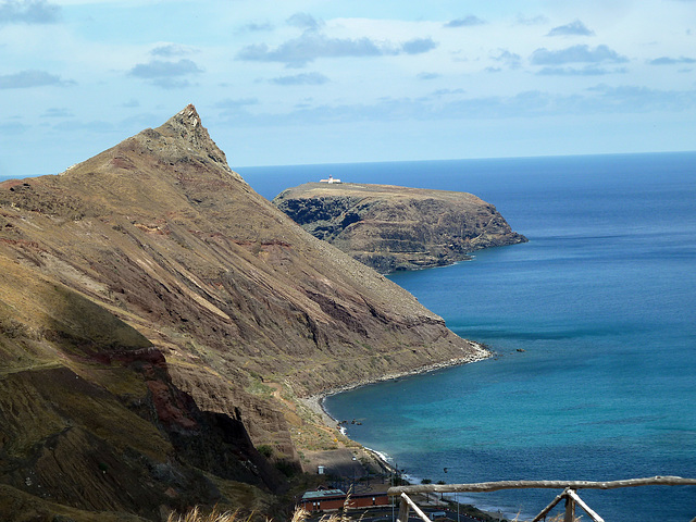
Blick zur Leuchtturminsel Ilhéu do Farol auf Porto Santo


Die Insel liegt rund einen Kilometer östlich der zur Inselgruppe Madeira gehörenden Insel Porto Santo. Die langgestreckte Insel ist in Ost-West-Richtung etwa 1,2 km lang, bis zu 500 m breit und erreicht eine Höhe von 111 m über dem Meer. Mit einer Fläche von 32 ha (0,32 km²) ist sie nach der Ilhéu da Cal die zweitgrößte der Porto Santo vorgelagerten Eilande, der sogenannten Ilhéus do Porto Santo. Wie sämtliche dieser Eilande ist auch Ilhéu de Cima ein Natura-2000-Schutzgebiet. Im Osten der Insel befindet sich der 1900 erbaute und 15 m hohe Leuchtturm Farol do Ilhéu de Cima.
Wikipedia
Translate into English
Wikipedia
- Keyboard shortcuts:
Jump to top
RSS feed- Latest comments - Subscribe to the comment feeds of this photo
- ipernity © 2007-2024
- Help & Contact
|
Club news
|
About ipernity
|
History |
ipernity Club & Prices |
Guide of good conduct
Donate | Group guidelines | Privacy policy | Terms of use | Statutes | In memoria -
Facebook
Twitter

Sign-in to write a comment.