Landscapes
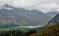
High view to Crummock Water
| |
|
|
|
Still on the Corpse Road we get a better view of the next lake here as we walk above Loweswater. Beyond Crummock is yet another lake; Buttermere, considered as one of the Lake Districts most beautiful lakes.
See Pip for alternative view
"Crummock Water is a lake in the Lake District in Cumbria, North West England situated between Buttermere to the south and Loweswater to the north. Crummock Water is 2.5 miles long, 0.75 mile wide and 140 feet deep."
Enjoy full size
The Corpse Road
| |
|
|
|
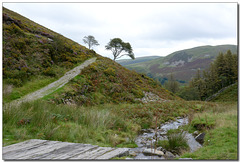
As we cross this small bridge we make a very distinctive line to that tree in the horizon. One can imagine a procession following a laden cart here.
'During the medieval period, the local population rose significantly and, consequently, so did the number of churches in the area. Keen to retain their authority and sustain revenues, senior ministers of existing parish churches made claims to burial rights over the area, thus resulting in the need for residents in outlying villages to travel a fair distance to bury their loved ones in the designated consecrated ground. Corpse roads were created to allow villagers to travel to their parish churches for this reason. One such corpse road ran from Buttermere to the church at Lamplugh, a village on the western edge of the Lake District. Part of the ancient route remains, and this walk follows it as it traverses the side of fells above Loweswater.' (https://www.thelakedistrict.org/things-to-do/walks/high-nook-tarn/)
Enjoy large
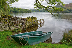
HFF - Anybody for a boat ride?
| |
|
|
|
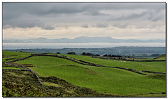
Another Loweswater fence shot for you here. In fact this is the same fence as in my last HFF offering (see Pip). This view west, towards our west coast beyond the hills has none of the exciting high vistas as can be seen to the other end behind me but I think you will agree that it is quite agreeable all the same.
HFF and I wish you all, a safe weekend, Herb
The Solway Firth
| |
|
|
|
My last photo from this high Corpse Road before dropping back down to Loweswater. The Nearest shores being about 18km (11m) from where I am standing. The far shores are actually the counties of Dumfries and Galloway in Scotland. As can be seen here, great areas of our extensive coast are now filled with windfarms. Good for the planet maybe but not the most natural things on the horizons.
“The Solway Firth is a firth that forms part of the border between England and Scotland, between Cumbria and Dumfries and Galloway. It stretches from St Bees Head, just south of Whitehaven in Cumbria, to the Mull of Galloway, on the western end of Dumfries and Galloway. The Isle of Man is also very near to the firth.” Wikipedia
Enjoy full screen
August in Cumbria
| |
|
|
|
Cumbria, an area in the North West of England, most famous perhaps for the National Park of The English Lake District but having more to offer on its extensive coast, towns, moors and pastures. Here we see another side of the lake of Loweswater where trees and wild flowers full of bees cascade from the high Fells towards the lake. A very small portion of which, can just be made out almost middle left. See PiP
Enjoy full screen
PS - I shall take a break from these Lake District scenes for a week or so now and return to my 2014 Wonders of Mallorca selections.
The grandeur of Loweswater
| |
|
|
|
A five photo panoramic view of the whole of this lake as seen from the high Corpse road.
To the left. Just above the corner hills you can just make out the Solway Firth and to the right we see Crummock Water in the far distance. We now carry on walking left before returning to our car parked on the left side of this lake. With this photo, one can easily place most of my preceding photos on here.
Enjoy full screen
The Wonders of Mallorca: The wild paradise of Maj…
| |
|
|
|
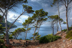
Enjoy with me the light on these wind-swept trees high above the Balearic Sea.
Continuing our fifth day near Deia, still on this West coast, we are now walking down the steep garden trail from the Son Marroig museum (see previous photo), down to the cove and headland at the waters edge itself where we will find our restaurant too.
Enjoy full size.
The Wonders of Mallorca: Trees of the Mediterranea…
| |
|
|
|
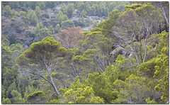
Deia - As we hike back up the steep path to the top of the hill overlooking the peninsula of Sa Foradada, a quick look to our side reveals these most attractive trees. How could I not try to do my best with them?
Old Nab
| |
|
|
|
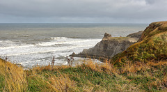
Just before reaching Staithes from the south, one passes this interesting headland quaintly called 'Old Nab' . The bay below is called 'Jet Wyke' where many ancient fossils can be found. If you look closely, you can just see a tent erected at its foot, quite an enterprise as during the past four or five days there has been a fierce storm raging along this coast. Its still windy today but it will soon calm down.
Enjoy full screen.
Stepping stones at the Craggs
| |
|
|
|
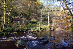
Autumn in Hardcastle Craggs can be most beautiful as well as exhilarating. Here we see one set of its stepping stones across Hebden Water. This is still a precursor of what it to come in this year of 2020 for it would not be quite like this here yet, a few weeks earlier. Memories of a wet foot as a few years ago I was crossing here and on landing on the stone across the gap I stepped back into the water. Some people don't grow up :)
Enjoy full size
Natures canvas
| |
|
|
|
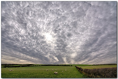
A big walk from Runswick Bay finds us on the cliff-tops looking inland (west) and one of those great skies that only come now and again. I could see the clouds starting to shape and move to this mackerel sky condition that was to herald bad weather to come but not on this walk. The sheep were quite unconcerned.
“A cirrocumulus mackerel sky is made up of wispier, patchier higher clouds. There are no thick lines and the clouds appear translucent. These clouds can run before a front and the accompanying bad weather. Cirrocumulus is often found with wispy cirrus, sometimes known as 'mares' tails' sky’ condition.” - Wiki
Enjoy full screen.
The Wonders of Mallorca: Embassament des Gorg Bla…
| |
|
|
|
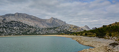
A day out in the mountains today and we head back up past the Cúber reservoir to its neighbouring reservoir of the Blue Gorge (Embassament des Gorg Blau). We are walking the full circuit of this with the hope of better weather never to really materialise. When one reads the description below, we can only imagine what it was like here before the reservoir was created.
“Gorg Blau is located in valleys between the Puig Major & Puig de Massanella and it is an artificial reservoir on the island of Majorca. Since 1971, together with Cuber, it provides water to the city of Palma and the surrounding areas. Gorg Blau starts at the reservoir, named the Gorg Blau Torrent and finishes in the Pareis Torrent. In 2003 it was declared as a natural monument by the Balearic Islands Government. Before the reservoir’s creation, in 1906, the place became famous by the combination of the elevation of the torrent’s walls, the blue of the waters & the bridge, which inspired artists such as poets, photographers or painters, a success that gave the place touristic quality and postcard photo.”
Enjoy full size.
The Wonders of Mallorca: Lakeside view
| |
|
|
|
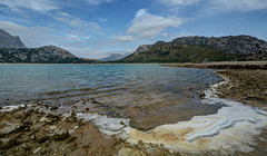
Another view of the Embassament des Gorg Blau here in the North West of Majorca. Surrounded by mountains, the most important Puig Major & Puig de Massanella we have only the sound of lapping waves to distract our senses. A fine walk around this reservoir today.
Enjoy full size.
The Wonders of Mallorca: Blue Gorge Refugio
| |
|
|
|
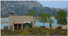
As we continue this hike around this reservoir, we come across a Spanish Refugio. This shelter for hikers to stay the night has obviously been recently renovated but manages to keep its charm.
Enjoy full size.
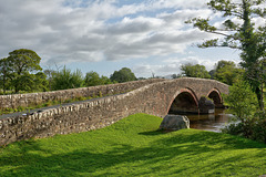
A bridge of ‘Nether Wasdale’
| |
|
|
|
Today is a grand ‘Wast Water’ walk and this bridge soon caught my eye. I tried to find exactly what this bridge was called but for the life of me I could not. We parked at a little carpark in a spot called ‘Cinderdale Bridge’ –which of course has a bridge, but on research via Google images etc, it is a single span stone bridge as is its close neighbour ‘Forest Bridge’ too. Anyway, here is my double arched bridge over what should be the River Irt, and it is quite typical of the narrow hump-back bridges of this area. Hope you enjoy it.
Enjoy full screen
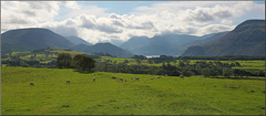
To Ennerdale Water
| |
|
|
|
A view from Ennerdale Bridge of this Western lake and its surroundings. In a few days time we shall walk around the lake but in the meantime enjoy it from here.
The Pip shows a slightly different view on my way to this spot. As you can see, this is sheep country.
Essential full screen
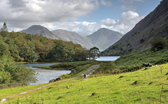
A first look at WastWater
| |
|
|
|
As we pass Low Wood on the left we find ourselves at the very southern end of this lonely West Lake District lake, called more correctly a ‘Water’ in common with all but one of the sixteen ‘Lake District’ lakes not being called lakes at all, instead being ‘Meres’ and ‘Waters’. The most prominent hill here is Yewbarrow at 628m resembling the upturned hull of a boat or a barrow.
As usual the landscape is dotted with local sheep. The PiP’s, are taken from the same hillside and possibly in your opinion may have merited having been the main photo here.
Enjoy full screen
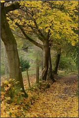
Golden path of memories fence
| |
|
|
|
As todays wind blows away many of our autumn leaves we see here a path that we strolled along just a week or so ago. This brings back special memories for me, as our old home was only about 75 meters from here, so I walked it many times through all seasons and weathers. The path dips down here and then over a small brook via a tiny clapper bridge. Another 700 meters and we arrive at the impressive ‘Tandle Hills Park’ filled with trees like this.
HFF. Have a safe and enjoyable weekend.
Jump to top
RSS feed- Latest items - Subscribe to the latest items added to this album
- ipernity © 2007-2024
- Help & Contact
|
Club news
|
About ipernity
|
History |
ipernity Club & Prices |
Guide of good conduct
Donate | Group guidelines | Privacy policy | Terms of use | Statutes | In memoria -
Facebook
Twitter

