Wasser
Flashback
Wasserball auf dem Rathausplatz
| |
|
|
|
Wasserspiele
| |
|
|
|
Auf dem Weg nach Molde
| |
|
|
|
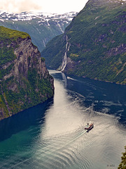
Geiranger-Fjord und die 7 Schwestern
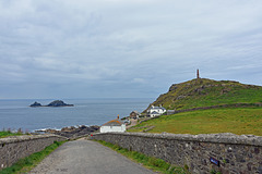
Cape Cornwall
| |
|
|
|
Cape Cornwall (kornisch: Pen Kernow) ist eine schmale Landspitze in Cornwall, Großbritannien. Sie liegt ca. 6,7 Kilometer nördlich vom Land’s End in der Nähe von St Just in Penwith.Der Atlantik wird vom Kap in mehrere Gewässer aufgeteilt: Im Norden beginnt hier der Bristolkanal sowie die Irische See und im Süden der Ärmelkanal. Früher galt die Landspitze als westlichster Punkt Englands, bis genaue Messungen ergaben, dass Land's End der westlichste Punkt ist.Am Cape Cornwall befinden sich ein Aussichtspunkt, ein Parkplatz und öffentliche Toiletten für die Touristen. Der Schornstein auf der Spitze der Landzunge ist ein Denkmal, das an den Bergbau und den damit verbundenen Erzabbau im Bergbaurevier St Just erinnern soll. In direkter Nachbarschaft befindet sich die Letcha Mine, deren Schornstein etwa 800 südöstlich vom Cape Cornwall zu sehen ist. Viele Spuren der Industrialisierung dieser Landschaft sind bis heute erhalten geblieben, das Gebiet um St. Just steht als UNESCO-Welterbe seit 2006 unter besonderem Schutz. Im Meer vor dem Cape liegen "the Brisons", zwei Felsen, die aussehen wie Charles de Gaulle auf dem Rücken liegend.
Cape Cornwall (Cornish: Kilgoodh Ust, meaning "goose back of St Just") is a small headland in west Cornwall, England, UK. It is four miles north of Land's End near the town of St Just.
A cape is the point of land where two bodies of water meet and until the first Ordnance Survey, 200 years ago, it was thought that Cape Cornwall was the most westerly point in Cornwall. Most of the headland is owned by the National Trust. There is also a National Coastwatch look out on the seaward side. The only tourist infrastructure at present is a car park (owned by the National Trust) and a public toilet and refreshments van during the summer.
The Brisons, two offshore rocks, are located approximately one mile southwest of Cape Cornwall and are the starting line of the annual swimming race ending at Priest Cove.
Just one mile from the Cape is the westernmost school on the British mainland, Cape Cornwall School. This is Cornwall's smallest secondary school with (as of January 2008) about 450 young people aged 11 to 16. Commonly known as "Cape" it is Cornwall's only school that specialises in art, photography and music. Most of its pupils come from the town of St Just in Penwith and the nearby villages of Pendeen, Sennen, St Buryan and St Levan but over 10% travel to the school from Penzance and further east.
Dartmoor
| |
|
|
|
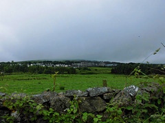
Das Gefängnis ist die große Häusergruppe, fast in der Mitte hinten.
Neben den bekannteren und weniger bekannten Sehenswürdigkeiten Dartmoors gehören die verstreut liegenden schönen Weiler und Dörfer zu den Anziehungspunkten; einigen von ihnen hat die Parkverwaltung den Status von „Conservation Areas“ zugesprochen. Am südöstlichen Rand des Parks ist die Kleinstadt Buckfastleigh einen Besuch wert; von dort fährt die South Devon Railway, eine wiederhergestellte Normalspur-Eisenbahnlinie, den Dart River entlang nach Totnes. Nahe der Stadt befindet sich die Benediktiner-Abtei Buckfast Abbey, eines der wenigen noch aktiven Klöster in Großbritannien.
Ganz im Norden des Parks liegt über dem Flusstal des Teign das Castle Drogo; es ist das letzte Landschloss, das in Großbritannien gebaut worden ist. Weiter flussabwärts kommt man zur Fingle Bridge, einem massiven, dreibogigen Bauwerk. Weiter nordwestlich geht es nach Lynford. Dort steht die Kirche St Michal’s de Rupe auf Brentor. In Lydford wurde 1195 das für seinen rüden Umgang mit Gefangenen bekannte erste Gefängnis Dartmoors erbaut.
Von Südwesten her fährt man durch das Zentrum des Parks auf alten Straßen über Bennet’s Cross und Warren House, dem abgelegensten Inn, zur Ortschaft Postbridge, wo die größte noch erhaltene, über den East Dart errichtete „clapper bridge“ zu sehen ist. Sie stammt aus dem 13. Jahrhundert und wurde erbaut, um das Zinn von den Minen mit Packpferden zu den Schmelzöfen von Tavistock und Chagford transportieren zu können. Der nächste Ort ist Princetown, bekannt für sein düsteres Zuchthaus, das 1806 ursprünglich für Gefangene aus den Napoleonischen Kriegen gebaut wurde. Der Ort beherbergt außerdem das Verwaltungszentrum der Duchy of Cornwall. Immer noch im Zentrum, aber in der Osthälfte, liegt das wahrscheinlich am häufigsten besuchte Dorf Dartmoors, Widecombe-in-the-Moor. Schon von weitem ist der 36 m hohe Turm der Gemeindekirche zu sehen. Er wurde nach 1638 errichtet; in jenem Jahr schlug während eines Gottesdienstes ein gewaltiger Blitz in das Gebäude ein und forderte vier Todesopfer.
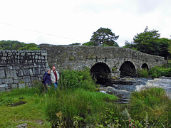
Dartmoor alte Brücke
| |
|
Dartmoor, Rundbogenbrücke gegenüber der Clapper Br…
| |
|
|
|
Picture ist taken from the Clapper Bridge.
Postbridge is a hamlet in the heart of Dartmoor in the English county of Devon. It is situated on the B3212, roughly midway between Princetown and Moretonhampstead.
Postbridge is situated next to the East Dart river, one of two main tributaries of the River Dart, and consists of a few houses, a shop, a pub, and a national park tourist information centre.
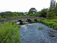
Postbridge is best known for its fine example of an ancient clapper bridge over the river. First recorded in the 14th century, the bridge is believed to have been built in the 13th century to enable pack horses to cross the river, carrying tin to the stannary town of Tavistock. The clapper bridge which is a Grade II* listed structure, is still complete, and stands alongside another bridge, a Grade II listed structure built in the 1780s
Cadgwith, Cornwall
| |
|
|
|
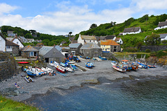
Cadgwith (Cornish: Porthkajwydh, meaning cove of the thicket) is a village and fishing port in Cornwall, England, United Kingdom. It is on the Lizard Peninsula between The Lizard and Coverack.
The village has its origins in medieval times as a collection of fish cellars in a sheltered south-east facing coastal valley with a shingle cove. Fishing subsidised local farmers' livelihoods. Cadgwith was originally called 'Porthcaswydh', becoming 'Por Cadjwydh' in Late Cornish, and is derived from the Cornish word for 'a thicket', literally meaning battle of trees, probably because the valley was densely wooded. From the 16th century, the village became inhabited, with fishing as the main occupation. Subsequently houses, lofts, capstan houses, and cellars constructed of local stone or cob walls and thatched or slated roofs were built along the beach and up the sides of the valley leading to Cadgwith's characteristic Cornish fishing village appearance. In recent times a very small Anglican church was built, next to the path from the car park down to the seafront, dedicated to St Mary. Q:Wikipedia
Coverack Hafen
| |
|
|
|
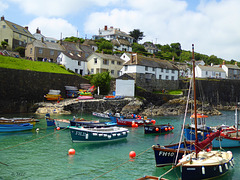
Coverack ist ein kleiner Ort an der Südküste von Cornwall. Die Fischer sind mit kleinen Booten zum fischen rausgefahren, alles strahlte eine zufriedene Ruhe aus. Das Cafe in dem kleinen Haus oberhalb der Treppe nutzte die öffentlichen Bänke an der Straße.
Coverack (Cornish: Porthkovrek, meaning cove of the stream) is a coastal village and fishing port in Cornwall, UK. It is on the east side of the Lizard peninsula, about nine miles south of Falmouth.
Coverack has several hotels and a youth hostel. The area is a centre for watersports, particularly wind surfing, sailing and diving. The nearby rocks known as The Manacles have been the site of many shipwrecks and as a consequence are now a favourite diving destination.
Lizard Point, Cornwall
| |
|
|
|
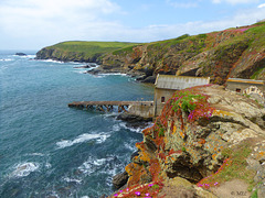
Lizard Point in Cornwall ist der südlichste Punkt der Lizard Halbinsel und gleichzeitig der südlichste Punkt Englands auf der Hauptinsel Großbritanniens. Sein nördliches Gegenstück ist Dunnet Head in Schottland.
Lizard Point markiert die nördliche Einfahrt in den Ärmelkanal und ist der einzige Landpunkt der britischen Hauptinsel, der – wenn auch nur eine Winzigkeit – südlicher als der 50. Breitengrad gelegen ist (entspricht dem deutschen Mainz oder dem nordfranzösischen Amiens); selbst Land’s End, das fälschlicherweise oft als der südlichste Punkt Englands angesehen wird, liegt nördlich des 50. Breitengrades.
Direkt auf der Spitze befinden sich einige Häuser, der eigentliche Ort The Lizard befindet sich etwa einen Kilometer nördlich. Unterhalb der Häuser an der Spitze befindet sich die alte Station der Royal National Lifeboat Institution, die aber nicht mehr in Betrieb ist. Des Weiteren stehen etwas östlich der Spitze die beiden Leuchttürme Lizard Lighthouse, von denen nur noch einer in Betrieb ist. Daneben befindet sich das in viktorianischer Zeit gebaute Hotel, das vom National Trust verwaltet wird, um es vor dem Verfall zu schützen. Es wird heute als Jugendherberge genutzt (YHA Lizard Youth Hostel). Ebenso wie das Hotel befindet sich auch Lizard Point im Besitz des National Trust und steht damit seit 1987 unter dessen Schutz.
Im Sommer kommen pro Tag bis zu 2500 Besucher an den Lizard Point. Um die Landschaft zu schützen, und den Durchgangsverkehr vom Besucherverkehr zu trennen, hat der National Trust Wege und Parkplätze angelegt. Zur Verschönerung der Landschaft wurden oberirdisch verlegte Strom- und Telefonkabel in den Boden verlegt und 51 Telegrafenmasten entfernt.
Lizard Point (from Cornish an Lysardh, meaning "the high court") in Cornwall is at the southern tip of the Lizard Peninsula. It is situated half-a-mile (800 m) south of Lizard village in the civil parish of Landewednack and about 11 miles (18 km) southeast of Helston.
Lizard Point is the most southerly point on mainland Great Britain at 49° 57' 30" N. With the exception of parts of the Isles of Scilly it is the southernmost part of England.
Lizard Point is for many ships the starting point of their ocean passage and a notorious shipping hazard. The Lizard Lighthouse is situated at Lizard Point. Immediately below the lighthouse, situated in what used to be a hotel, is the YHA Lizard Youth Hostel. Lizard Point is situated within Caerthillian to Kennack SSSI (Site of Special Scientific Interest), noted for its biological and geological interest. Polpeor Cove is a small cove to the east of Lizard Point.
The area is famous for its carved serpentine items, which range from ornaments to the pump handles in the local public house, the Lizard Inn (The Top House). The geology of Lizard can be interesting to some, with a number of planned walks available from local tourist authorities to discover more about the local rocks.
The first sighting of the Spanish Armada on mainland Britain was off Lizard Point at 3 pm on 29 July 1588. This was one of the greatest invasion fleets in history and consisted of 120 ships armed with over 1,000 cannon and with 29,000 men on board.
The Battle at the Lizard, a naval battle, took place off The Lizard on 21 October 1707. Q:Wikipedia
Canada Place und Convention Centre
| |
|
|
|
Canada Place ist ein markantes Gebäude im Zentrum der kanadischen Stadt Vancouver, am Ufer des Burrard Inlet. Es beherbergt das Messe- und Kongresszentrum Vancouver Convention & Exhibition Centre, das Pan Pacific Hotel und das weltweit erste IMAX-Kino. Darüber hinaus ist es Anlegestelle der meisten ab Vancouver verkehrenden Kreuzfahrtschiffe.
Erbaut vom Architekten Eberhard Zeidler als kanadischer Pavillon der Expo 86, war Canada Place der einzige Teil dieser Weltausstellung, der sich nicht auf dem Ausstellungsgelände am Nordufer des False Creek befand.
Canada Place is a building situated on the Burrard Inlet waterfront of Vancouver, British Columbia. It is the home of the Vancouver Convention Centre, the Pan Pacific Vancouver Hotel, Vancouver's World Trade Centre, and FlyOver Canada (a virtual flight ride which replaced the world's first permanent IMAX 3D theatre and which ceased operation on October 1, 2009). The building's exterior is covered by fabric roofs resembling sails. It is also the main cruise ship terminal for the region, where most of Vancouver's famous cruises to Alaska originate. The building was designed by architects Zeidler Roberts Partnership in joint venture with Musson Cattell Mackey Partnership and DA Architects + Planners.
Canada Place can be reached via the SkyTrain line at the nearby Waterfront Station terminus or via West Cordova Street in Vancouver. The white sails of the building have made it a prominent landmark for the city, as well as drawing comparisons to the Sydney Opera House in Sydney, Australia and the Denver International Airport in Denver, Colorado.[citation needed]
The structure was expanded in 2001 to accommodate another cruise ship berth and in 2009/10, for the 2010 Winter Olympics, Canada Place served as the Main Press Centre. Q:Wikipedia
Die Bank und der Zaun in Port Alberni
| |
|
|
|
HFF to all and have a nice weekend
Port Alberni ist eine Stadt mit knapp 18.000 Einwohnern in der kanadischen Provinz British Columbia. Sie befindet sich auf der Insel Vancouver Island am Ende des Alberni Inlet und ist Hauptort des Verwaltungsbezirks Alberni-Clayoquot.
Für die Wirtschaft der Region, aber auch die Kultur der First Nations, ist der Pacific-Rim-Nationalpark ebenso von erheblicher Bedeutung wie der Strathcona Provincial Park und der Sproat Lake.
In der Umgebung des Ortes und im Ort selbst leben Angehörige der Nuu-chah-nulth, etwa von den umwohnenden First Nations der Tseshaht, Hupacasath, Huu-ay-aht oder Hesquiaht.
Port Alberni is a city located on Vancouver Island in the province of British Columbia, Canada.
Port Alberni is well known for offering affordable real estate and an active lifestyle. The city has a total population of 17,743, and a census agglomeration area of 25,396.
Port Alberni is a deep port city which lies within the Alberni Valley at the head of the Alberni Inlet, Vancouver Island's longest inlet. It is the location of the head offices of the Alberni-Clayoquot Regional District. Q:Wikipedia
Canada Place
| |
|
|
|
Canada Place ist ein markantes Gebäude im Zentrum der kanadischen Stadt Vancouver, am Ufer des Burrard Inlet. Es beherbergt das Messe- und Kongresszentrum Vancouver Convention & Exhibition Centre, das Pan Pacific Hotel und das weltweit erste IMAX-Kino. Darüber hinaus ist es Anlegestelle der meisten ab Vancouver verkehrenden Kreuzfahrtschiffe.
Erbaut vom Architekten Eberhard Zeidler als kanadischer Pavillon der Expo 86, war Canada Place der einzige Teil dieser Weltausstellung, der sich nicht auf dem Ausstellungsgelände am Nordufer des False Creek befand.
Canada Place is a building situated on the Burrard Inlet waterfront of Vancouver, British Columbia. It is the home of the Vancouver Convention Centre, the Pan Pacific Vancouver Hotel, Vancouver's World Trade Centre, and FlyOver Canada (a virtual flight ride which replaced the world's first permanent IMAX 3D theatre and which ceased operation on October 1, 2009). The building's exterior is covered by fabric roofs resembling sails. It is also the main cruise ship terminal for the region, where most of Vancouver's famous cruises to Alaska originate. The building was designed by architects Zeidler Roberts Partnership in joint venture with Musson Cattell Mackey Partnership and DA Architects + Planners.
Canada Place can be reached via the SkyTrain line at the nearby Waterfront Station terminus or via West Cordova Street in Vancouver. The white sails of the building have made it a prominent landmark for the city, as well as drawing comparisons to the Sydney Opera House in Sydney, Australia and the Denver International Airport in Denver, Colorado.
The structure was expanded in 2001 to accommodate another cruise ship berth and in 2009/10, for the 2010 Winter Olympics, Canada Place served as the Main Press Centre. Q:Wikipedia
Der Zaun am Emerald Lake, Yoho National Park, Cana…
| |
|
|
|
HFF - Happy Fence Friday to you
Emerald Lake is located in Yoho National Park, British Columbia, Canada. It is the largest of Yoho's 61 lakes and ponds, as well as one of the park's premier tourist attractions. Emerald Lake Lodge, a high-end lodge perched on the edge of the lake, provides local accommodation. A 5.2 km (3.2 mi) hiking trail circuits the lake, the first half of which is accessible to wheelchairs and strollers. During the summer months, canoe rentals are available; in the winter, the lake is a popular cross country skiing destination.
The lake is enclosed by mountains of the President Range, as well as Mount Burgess and Wapta Mountain. This basin traps storms, causing frequent rain in summer and heavy snowfalls in winter. This influx of moisture works with the lake's low elevation to produce a unique selection of flora. Trees found here are more typical of B.C.'s wet interior forests, such as western red cedar, western yew, western hemlock and western white pine. The alluvial fan on the northeast shore produces wildflowers in abundance during late June and early July.
Due to its high altitude, the lake is frozen from November until June. The vivid turquoise color of the water, caused by powdered limestone, is most spectacular in July as the snow melts from the surrounding mountains.
The first European to set sight on Emerald Lake was guide Tom Wilson, who stumbled upon it by accident in 1882. A string of his horses had gotten away, and it was while tracking them that he first entered the valley. The lake had an impression on even the most seasoned of explorers: "For a few moments I sat [on] my horse and enjoyed the rare, peaceful beauty of the scene." It was Wilson who gave the lake its name because of its remarkable colour, caused by fine particles of glacial sediment, also referred to as rock flour, suspended in the water. However, this was not the first time Wilson had dubbed a lake 'Emerald'. Earlier that same year he had discovered another lake which he had given the same moniker, and the name even appeared briefly on the official map. This first lake however, was shortly renamed Lake Louise. Q:Wikipedia
Weinberge im Okanangan Valley, BC, Canada - PIP
| |
|
|
|
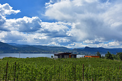
PIP - Die Winzer dort haben noch recht bescheidene Anwesen
Okanagan Lake ist ein langer, schmaler Binnensee in der kanadischen Provinz British Columbia. Der rund 135 km lange und 4-5 km breite See mit einer Oberfläche von 351 km² schlängelt sich im südlichen Teil von British Columbia durch das Okanagan-Becken und geht rund 55 km vor der Grenze zum US-Bundesstaat Washington in den gleichnamigen Fluss über.
Die größte Stadt am Ufer des Sees ist mit 117.312 Einwohnern Kelowna, die sich Anfang des 20. Jahrhunderts entwickelte, als zahlreiche Europäer das Tal besiedelten. Die Bewohner entlang des Sees, darunter viele deutschstämmige Kanadier, leben insbesondere vom Fremdenverkehr, sowie von der Land- und Forstwirtschaft. Insbesondere in Kelowna entwickelte sich zudem ein ertragreiches Dienstleistungsgewerbe. Die Gegend ist innerhalb von Kanada insbesondere für den Anbau von Obst und Wein bekannt.
Der Legende nach lebt im Okanagansee das Seeungeheuer Ogopogo.
Okanagan Lake is a large, deep lake in the Okanagan Valley of British Columbia, Canada. The lake is 135 km long, between 4 and 5 km wide, and has a surface area of 348 km².
Okanagan Lake is called a fjord lake as it has been carved out by repeated glaciations. Although the lake contains numerous lacustrine terraces, it is not uncommon for the lake to be 100m deep only 10m offshore. Major inflows include Mission, Vernon, Trout, Penticton, Equesis, Kelowna, Peachland and Powers Creeks.[7] The lake is drained by the Okanagan River, which exits the lake's south end via a canal through the city of Penticton to Skaha Lake, whence the river continues southwards into the rest of the South Okanagan and through Okanogan County, Washington to its confluence with the Columbia.
The lake's maximum depth is 232 metres near Grant Island (Nahun Weenox). There is one other island known as Rattlesnake Island, much farther south by Squally Point. Some areas of the lake have up to 750 metres of glacial and post-glacial sediment fill which were deposited during the Pleistocene Epoch.
Notable features of the Okanagan Valley include terraces which were formed due to the periodic lowering of the lake's predecessor, glacial Lake Penticton. These terraces are now used extensively for agriculture such as fruit cultivation. Q:Wikipedia
Lillooet Lake
| |
|
|
|
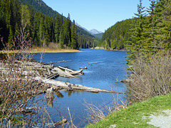
Lillooet Lake ist ein See in der kanadischen Provinz British Columbia.
Der See liegt in den südlichen Coast Mountains, etwa 120 km nordnordöstlich von Vancouver. Er wird vom Lillooet River in südlicher Richtung durchflossen. Ein weiterer Zufluss an seinem nördlichen Ende ist der Birkenhead River. 12 km nördlich des Sees befindet sich der Ort Pemberton. Der See hat eine Länge von 25 km und eine Wasserfläche von 33,5 km². Wenige Kilometer südlich des Sees befindet sich der Little Lillooet Lake, der ebenfalls vom Lillooet River durchflossen wird.
Lillooet Lake is a lake in British Columbia, Canada about 25 km in length and about 33.5 square kilometres (22 mi²) in area. It is about 95 km downstream from the source of the Lillooet River, which resumes its course after leaving Little Lillooet Lake, aka Tenas Lake (tenass in the Chinook Jargon means little). Immediately adjacent to the mouth of the upper Lillooet River is the mouth of the Birkenhead River and just upstream along the Lillooet is the confluence of the Green River, which begins at Green Lake in the resort area of Whistler.
The community of Pemberton is about 12 km upstream from the head of Lillooet Lake, while the eastern edge of the Mount Currie Indian Reserve of the Lil'wat branch of the St'at'imc people is the lakeshore itself. The eastern ramparts of the mountain ranges of Garibaldi Provincial Park overlook Lillooet Lake from the west, while to the east are the northern reaches of the Lillooet Ranges which lie between the Lillooet-Harrison drainage and the Fraser River.
Lillooet Lake was part of the "Lakes Route" or Douglas Road, once if only briefly the principal route between the Coast and the Interior during the days of the Fraser Canyon Gold Rush. Several steamers and innumerable smaller watercraft served the busy freight and passenger traffic in those days. The best-known and largest of these was the SS Prince of Wales, whose wreckage was visible on the shores of the lake near Mount Currie for many years.
Jump to top
RSS feed- Latest items - Subscribe to the latest items added to this album
- ipernity © 2007-2024
- Help & Contact
|
Club news
|
About ipernity
|
History |
ipernity Club & Prices |
Guide of good conduct
Donate | Group guidelines | Privacy policy | Terms of use | Statutes | In memoria -
Facebook
Twitter

